OUR BLOG
Latest Updates & News
Your trusted source for no-bull Texas weather information since 2009. We provide down-to-earth and easy-to-understand statewide and local weather updates during periods of active weather.

April 26, 2024 LIVE Texas Tornado/Severe Weather Coverage 3
April 26, 2024 #LIVE #Texas #Tornado coverage from Baldy-in-Chief David...
April 26, 2024 LIVE Texas Tornado/Severe Weather Coverage 2
April 26, 2024 #LIVE #Texas #Tornado coverage from Baldy-in-Chief David...

Texas Weather: Weekend Severe Storms On The Horizon!
https://youtube.com/live/ZzfUskdIWmI Episodes of severe thunderstorms, each with their own unique characteristics, are...
West/Northwest Texas: Severe Storms Likely After 11 PM into Early Friday
Scattered to several severe thunderstorms are likely late tonight into...

Texas: Severe Storms On The Horizon Tonight Through Sunday
https://youtu.be/in89kq7bffI?si=onXbJ5fitTj0HUR_ The chance of severe thunderstorms – capable of producing damaging...

Texas Region Map: A Guide to Geographic Locations & Names
Many have asked, and we're happy to share that we have finally created a graphic with a Texas regional map and...

Texas Faces Several Days Of Severe Thunderstorms Ahead
https://youtu.be/zy9FD0hSq28 Daily chances for rowdy thunderstorms and windy conditions will be two weather concerns...

Severe Thunderstorm Chances Returning to Texas
https://youtu.be/g0SO_5TdB8M Unsettled weather will bring a return of thunderstorm chances to parts of Texas over the...
Texas Weather: Brief Tranquility before Daily Storm Chances Return
The weekend rain is gone, but Texas is starting off on the chilly side of the thermometer this late April morning....
Texas: Battle of the Seasons, Heavy Rains, Few Severe Storms! {JC}
Happy weekend Texas! David is out of town but Jason will give a weather...
🔴 LIVE TEXAS CHASE: Isolated Gorilla Hailer in NW TX (4/23) {A}
@AdamLucio and @chelseaburnettwx are out in Northwest #Texas today to...

Texas Set To Cool Down And Get Wet This Weekend!
https://youtu.be/tZd6BxRdH_o A strong cold front will bring a little chill back to Texas this weekend with widespread...

Texas Forecast: Severe Storms Possible After 3 PM
https://youtu.be/f0Z3y4lc-_0 Active weather returns to Texas for the remainder of the week. Today's scattered severe...
Texas: Severe Storms Tomorrow; Rain & Much Cooler by Saturday
Texas’s hot weather will end this weekend as a cold front brings...

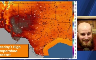
Texas: Summer-like Heat before Cold Front & Storms Arrive Late Week
https://www.youtube.com/watch?v=czAhPxWGG0Q A few showers and storms with small hail are possible in the Ark-La-Tex...
Isolated Severe Storms Chances Return to Texas Today
Monday’s are already challenging, and now we have the added complexity of...
LIVE CHASING: TORNADO WATCH IN OHIO (4/17/24) {S}
Stephen Jones @TornadoSteejo is in Central #Ohio to chase for the third...
LIVE CHASING: Significant Tornado Threat in Iowa! (4/16) {S-A}
NOT for rebroadcast or embedding. Email us at...
Texas: Severe Storms this Monday? Here’s the Latest
Latest severe weather outlook and forecast discussion for Texas Monday &...
LIVE CHASING: Widespread Severe Storms Texas to Nebraska (4/15) {S-J-A}
All hands on deck April 15th with multiple live stream cameras across...