
The radar is lit up like a Christmas tree this morning over the Big Country into parts of Central Texas. However, the low levels of the atmosphere are quite dry. Most of the rain is evaporating before reaching the ground. That could change later on this afternoon in the Big Country, and will definitely change tonight in parts of South Texas Texas and Southeast Texas. Sprinkles and light showers will be possible today in the Big Country. By tonight we’ll see scattered showers increase across Northeast Texas, East Texas, into the Brazos Valley and South-Central Texas. Numerous showers are expected on Saturday in East Texas, Southeast Texas, and the Brazos Valley. Isolated showers are also possible on Saturday in the Borderland.
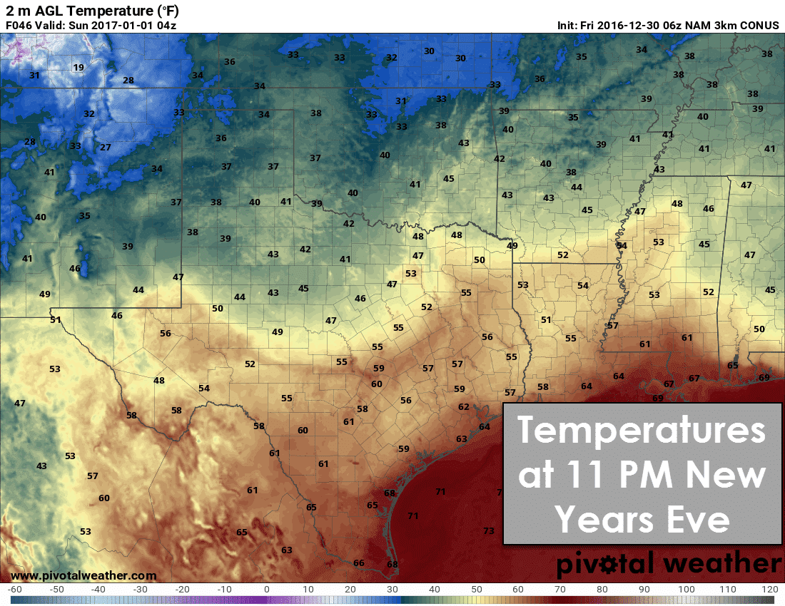
It looks like we’re going to get mostly lucky for New Years Eve festivities with a lull in the rain. A few showers will remain possible in far East Texas and Southeast Texas during the evening hours Saturday. Isolated rain will also be possible in the Texas Panhandle south into the Permian Basin. Temperatures will range from the 30s in the Panhandle to upper 50s in South-Central and Southeast Texas down into the Rio Grande Valley. We’ve certainly had far colder New Years Eve nights in recent years, so we’ll take it! Just be sure to dress warmly if you’re on the north side of the cool front – which should be located in the Big Country to Central Texas.
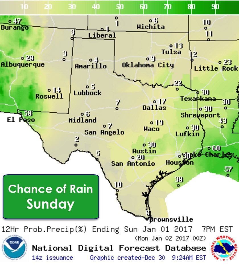
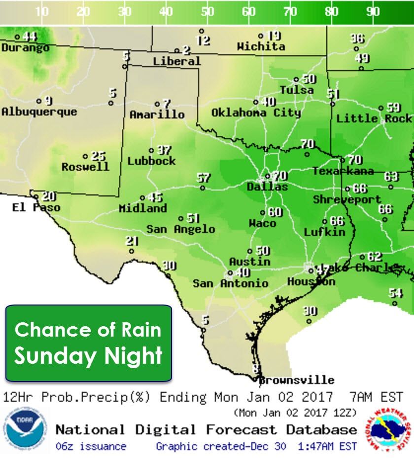

Rain and thunderstorm chances increase on Sunday into Sunday Night as our next storm system arrives. We do note that the Storm Prediction Center has placed a large marginal severe weather risk for Sunday and Sunday Night across Texas. This risk essentially includes the eastern two-thirds of Texas. A few stronger storms may produce hail and gusty winds. Depending on how much surface-based instability is able to develop we could also see a low risk for an isolated tornado. Check back for updates as we’ll definitely be able to get more specific on any potential stormy problems with time.
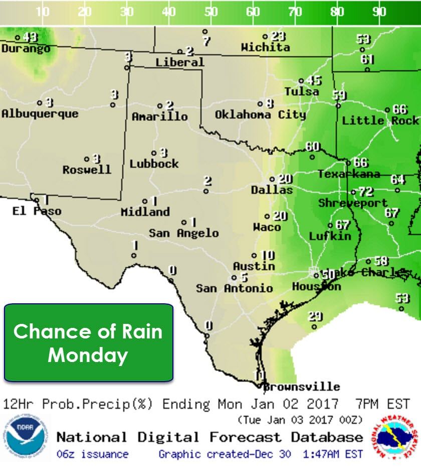
The highest rain chances on Monday will be east of Interstate 35 in Northeast Texas, East Texas, and Southeast Texas. A third storm system will bring high rain/storm chances by Monday Night back to more of Texas. Just after this forecast timeframe is when things get really interesting in the winter-weather department as an arctic cold front arrives.
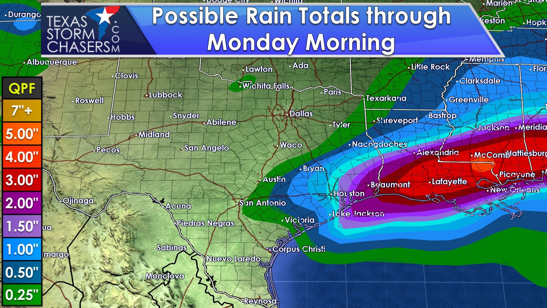
Through Monday Morning the highest rainfall totals – up to 2.5 inches – will be across Southeast Texas. Isolated flooding will be possible, but I don’t expect widespread flooding issues to develop this weekend. Rainfall amounts will generally be between half an inch and two inches across the Brazos Valley and Southeast Texas. Rainfall amounts decrease with north and west extent. Additional rain is expected after this forecast timeframe by Monday Night into Tuesday.
Temperatures will be near or above seasonal averages over the next three days. The coolest temperatures for most will be today before a warm front lifts north tonight into Saturday. You can see the warm front’s progress in the high temperature forecast graphics with the Texas Panhandle staying cold tomorrow, but warming up on Sunday. Enjoy the warmer weather because mother nature has payback coming in the form of an arctic outbreak next week.

An arctic cold front will start pushing into the Texas Panhandle and West Texas during the day on Tuesday. The front will push south at a good clip into Texoma, Northwest Texas, the Big Country, and North Texas during the nighttime hours Tuesday. It’ll continue to push south through much of Texas on Wednesday. Temperatures behind the front will be much colder. A storm system is expected to bring precipitation to parts of Texas on Wednesday Night into Thursday. There will be the potential for winter precipitation with this system, although as you might expected, weather models vary dramatically on the intensity/location of precipitation. We’ll have our first blog on the upcoming winter weather potential published this afternoon. Remember – forecasting winter weather in Texas is very difficult and generally isn’t “locked in” until we’re within 18-24 hours. Beyond that time frame any small changes in storm track or temperatures can result in major changes to the forecast. We’re talking about a system 6 days away, so you can bet things will change several times.


0 Comments