
Strong southerly winds, abudentely clear skies, and temperatures peaking in the 40s and 50s allowed much of any remaining snow to melt today. Keep in mind some of that may freeze into black ice in spots that go below freezing late tonight. Low temperatures will be 20 to 35 degrees warmer tonight into Monday morning than they were on Saturday. They’ll range from the lower 30s all the way up into the 40s. Southerly winds will remain noticeable overnight which will add a bit of a nip to the air.
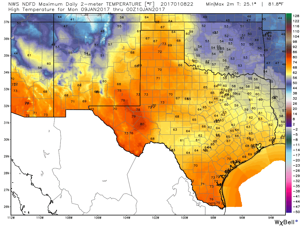
A big warm-up occurs on Monday across Texas as high temperatures soar into the 60s and 70s. Fire danger will be high with low humidity values, warm temperatures, and gusty winds. Even where snow fell this past week, the fire danger will be high. We don’t expect any precipitation until our next system by late week.

Now for a little public service announcement. There have been a few social media accounts posting raw weather model graphics of a nasty looking winter storm later this week. Forecasting winter weather in Texas is difficult enough 24 hours out from an event, not to even get out into the 6 day range. Depending on the amount of cold air available with the late week system we may see some sort of a winter mix in parts of Texas. It is way too soon to speculate on potential accumulations or where it’ll be a sleet/freezing rain event versus a cold rain. Confidence is high that we will see rain and storms by Friday and Saturday, but anything beyond that is pure speculation at this time. Stay tuned as some folks could be dealing with interesting weather.


0 Comments