
SPRING-LIKE WEATHER: Long gone are the arctic temperatures that brought winter weather to the state last week. High temperatures this afternoon and through Thursday will peak in the 60s, 70s, and 80s across Texas. We will start to see colder temperatures in the Texas Panhandle, West Texas, and Northwest Texas by Thursday as a shallow cold front slowly pushes in. This front will not make much progress to the east/south before our storm system arrives this weekend. Low temperatures along and east of Interstate 35 will be in the 60s for the next several days. Morning episodes of fog will be possibly daily.
UPCOMING STORM SYSTEM: Plenty of uncertainties remain with our upcoming storm system. One uncertainty remains on the timing of the storm system. Compared to yesterday’s thoughts the timing of the upcoming system has slowed by about 12 hours. That means we’ll be dealing with more of a Friday into Monday event versus a Thursday night into Sunday time-frame. Other uncertainties include how far south the storm system will ‘dig’, along with the overall intensity of the low-level cold air advection. Compared to yesterday we’ve also seen a warming trend in weather model guidance. Let’s dive into some of the more specific hazards.
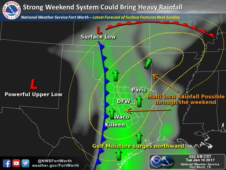
HEAVY RAIN POTENTIAL: This weekend and early next week’s system will have copious amounts of moisture to work with. We continue to see projected moisture values 200 to 350 percent above normal for January. That means we can expect some very high rainfall rates with the more efficient convection on Saturday, Sunday, and Monday. With the slower progression of the storm system we have seen timing pushed back a bit. We cannot accurately pin-down where the heaviest rains will fall as that will depend on mesoscale (or small-scale) features impossible for long-range weather models to comprehend. We should see a good soaking across parts of the state with a couple inches of rain possible. There will be the potential for higher rain totals, with rain totals over five inches, where the heaviest rains set-up shop. For now the highest chances appear to be along or east of Interstate 35 and towards the northern half of Texas. A localized flooding risk may develop in the Saturday-Monday timeframe. Some of our rivers, including the Brazos and Trinity, could start running high next week. We’ll start posting possible rainfall accumulation graphics once weather models start to show a more precise picture. Hopefully that’ll be by Thursday.
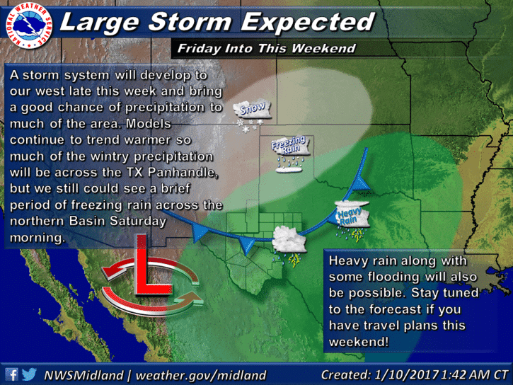
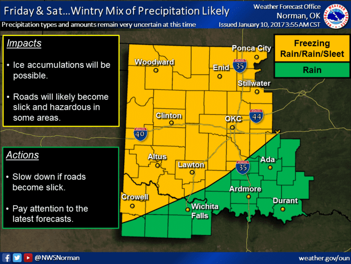
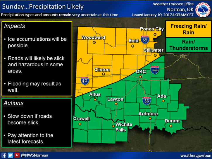
WINTER WEATHER MISCHIEF: Some good news is the chances for winter weather have decreased in the Concho Valley, southern half of the Big Country and North Texas with this upcoming system. The slower progression of the storm system plus a slightly warmer air mass mean temperatures should remain safely above freezing. Of-course I encourage you to check back for forecast updates in case that changes. There may the possibility of freezing rain in portions of Northwest Texas during the nighttime hours Friday into the morning hours Saturday. This threat would extend back west into the Texas Panhandle and perhaps portions of West Texas. During the day Saturday we should see the freezing line slowly move north as warmer air moves north. There is the possibility of a winter mix in the Texas Panhandle and perhaps parts of West Texas during the night Saturday into the morning hours Sunday. It is our hope that the freezing line will move north through the day Sunday and change all precipitation over to rain by the afternoon hours. All of this is speculation at this point and will undoubtedly change as we get new data in towards the end of the week. This system may bring a winter storm to portions of the Texas Panhandle, West Texas, and Northwest Texas. Please check back for updates as we get closer to Friday-Saturday.
STRONG STORM RISK: The potential for a few strong storms may develop during the evening hours Sunday in Central Texas, but at this time the overall risk looks marginal. We’ll be able to refine any potential strong/severe storm risk once we’re closer in time and confidence in a particular forecast solution increases. Any risk, should it develop, looks isolated and localized based on the current data. Could that change? Yes, but it hasn’t yet over the past couple of days. The widespread rain will likely be the primary story this weekend along with some winter weather potential in the Texas Panhandle.
Overall we’re expecting a fairly busy weather weekend across Texas. There will be the potential for winter weather, heavy rain, storms, and localized flooding. At this time the risk for widespread severe storms looks low, the risk for localized flooding may exsist, and we could see an ice storm materialize across parts of the Texas Panhandle into West Texas. All the details will be refined as the forecast becomes more clear. This will happen as we get closer in time and we get in range of higher-resolution weather model data.


0 Comments