
Showers and a few thunderstorms continue this morning across portions of the eastern half of Texas. After six inches of rain in parts of Houston this morning we’ve seen flash flooding during the morning rush hour… again. Houston will experience a break in the rain later this morning before a second round moves in early this afternoon. We note that any additional rainfall will likely result in a renewed threat of flooding. Further west in Central Texas we’re looking at that second round of precipitation. Minor flooding has been reported in parts of Austin this morning, but much less so than in Houston. A flash flood warning remains in place for the Houston metro through 10:15 AM. We should see those conditions improve by lunch, but additional rain may result in new flooding conditions by this afternoon in some locations.
A final piece of upper level energy will swing through tonight before our first upper level storm system exits the region. This final wave could bring additional showers to the eastern half of Texas tonight. An additional one half inch to one inch of rain could occur with this round tonight. Widespread flash flooding is not expected, but we may see very localized problems develop if additional rains move over a location that’s already saturated. By the afternoon hours Thursday we should see most precipitation exiting Texas to the east. By Thursday night we’ll see dry conditions across Texas.
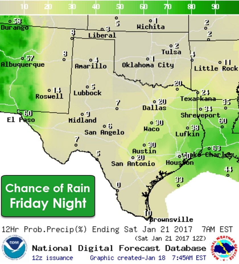
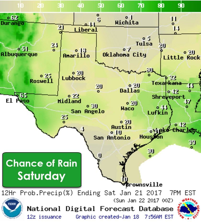
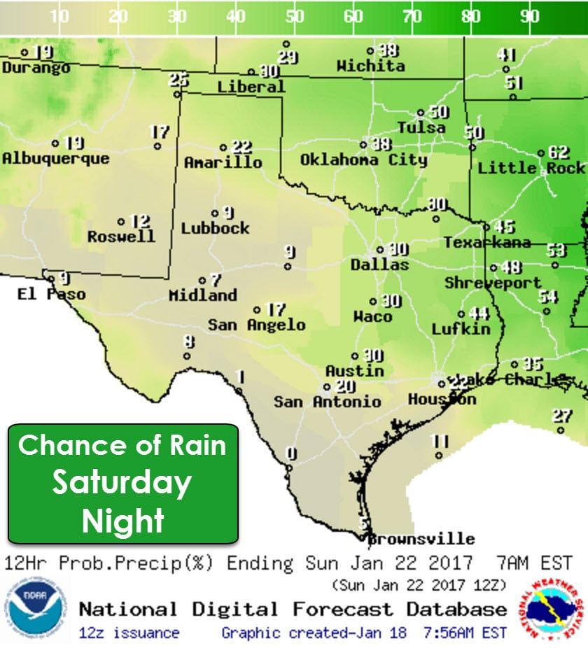
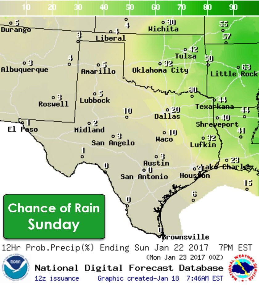
A much more significant storm system will move overhead this weekend. I say much more significant, but the storm impacts from this system so far look likely to remain off to our east. There will be a chance of showers as this system moves through on Saturday into the first half of Sunday. I cannot rule out an increased chance of severe thunderstorms in parts of East Texas and Southeast Texas on Saturday into Saturday Night, but at this time the highest threat appears to be off to our east. If the system slows and and instability values are able to increase we’d likely be dealing with some issues.
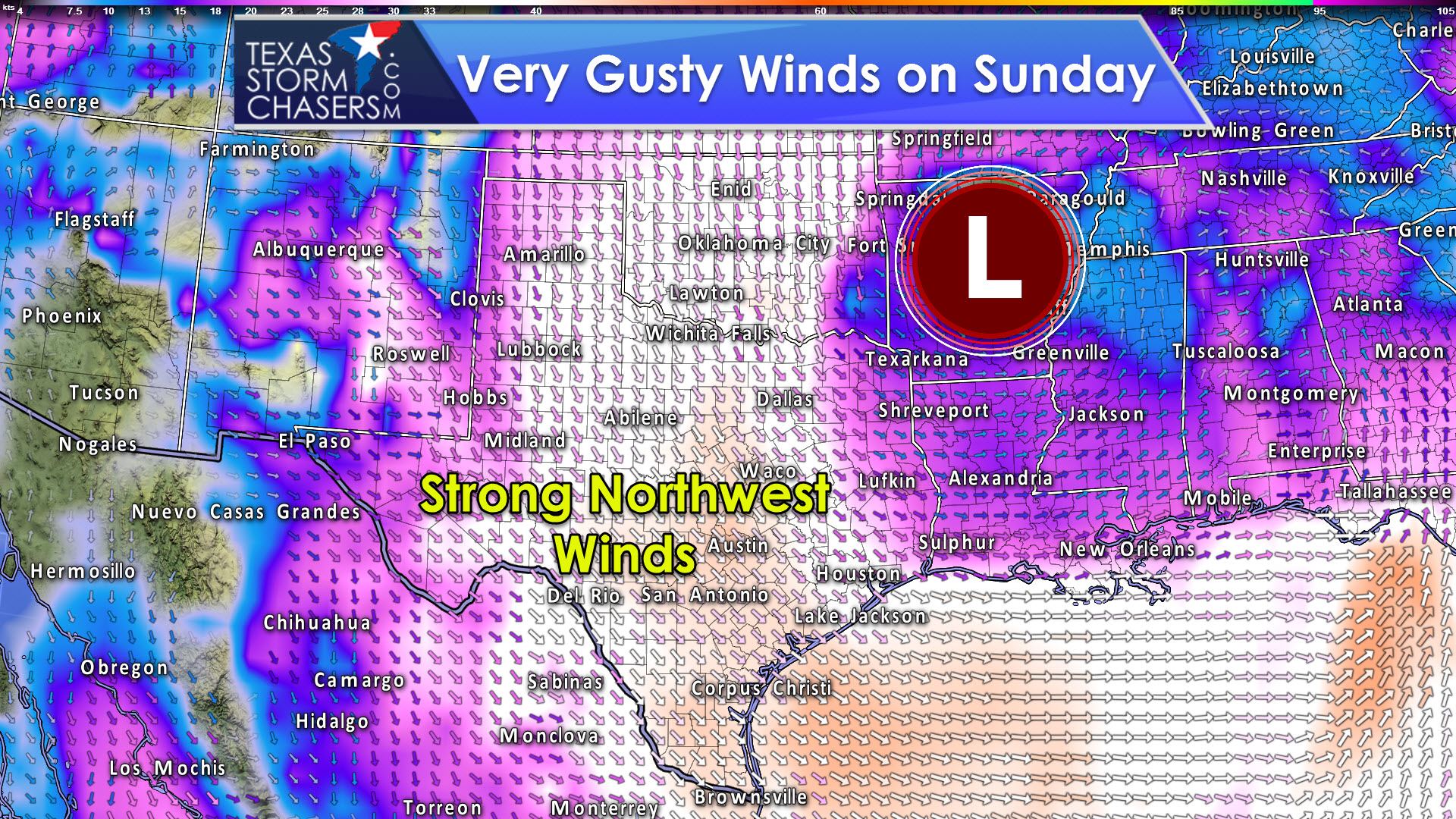
A powerful area of low pressure should be just off to our east/northeast by Sunday afternoon. This solution will probably change as we get closer to the weekend and data becomes more accurate. There is the potential for a high wind event across Texas on Sunday as the strong storm system passes off to our east. An intensifying low pressure could result in a impressive pressure gradient which would bring very gusty northwest winds – some possibly over 45 MPH. We’ll see how this threat evolves over the next couple of days.


0 Comments