https://youtu.be/tZd6BxRdH_o A strong cold front will bring a little chill back to Texas this weekend with widespread...


https://youtu.be/tZd6BxRdH_o A strong cold front will bring a little chill back to Texas this weekend with widespread...

https://youtu.be/f0Z3y4lc-_0 Active weather returns to Texas for the remainder of the week. Today's scattered severe...

https://www.youtube.com/watch?v=czAhPxWGG0Q A few showers and storms with small hail are possible in the Ark-La-Tex...

A total solar eclipse followed by a two-day severe weather outbreak has made for a busy week across Texas. We have one...
April 9, 2024 #LIVE #Texas #Tornado coverage from Baldy-in-Chief David...

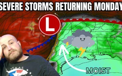
Thunderstorms will be the name of the game in Texas today, with continued chances of large hail and flooding rains in...
April 8, 2024 #LIVE #Texas #Tornado coverage from Baldy-in-Chief David...
April 8, 2024 #LIVE #Texas #Tornado coverage from Baldy-in-Chief David...

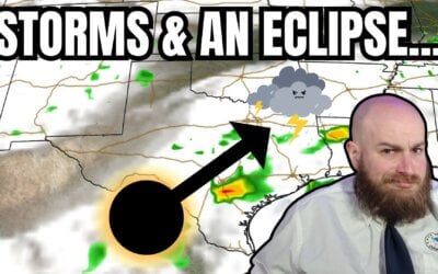
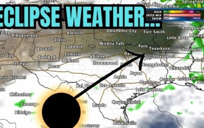
https://youtu.be/6sFEDoc8qbs The eclipse is hours away and clouds are moving north from the Gulf of Mexico. An...
Good evening! Here is a 9:30 pm update on tomorrow’s cloud cover potential...

https://youtu.be/inRPdmYrUk4 Texas is one day away from experiencing a generational event – a total solar eclipse....
A multi-faceted, multi-day severe thunderstorm and flooding event will follow an eclipse in Texas next week. The...
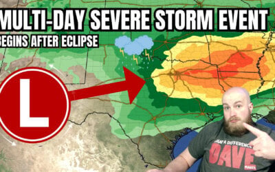
A multi-day severe storm event will follow an eclipse in Texas next week. Somehow, I figured Mother Nature wouldn’t...
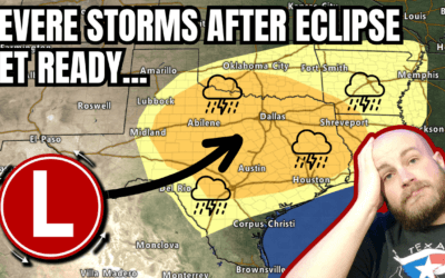
An eclipse for lunch and severe storms by dinner? Welcome to Texas weather in April. That appears to be on the agenda...
https://www.youtube.com/watch?v=MZYJZSo2TS0 All eyes are on the eclipse Texas weather forecast for Monday. We'll cover...
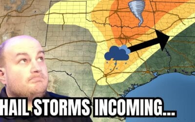
https://youtu.be/4F1q4r6gfh0 Parts of Texas will start April off with a literal bang—with the possibility of severe...
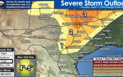
The potential for several intense supercell storms this afternoon and evening has increased in Texoma and North Texas...

https://youtu.be/NUYFE0yAXrs The final day of March has arrived, and so has Easter. May you enjoy the day the Lord has...
Warm and windy weather will close out March across Texas. Easter Weekend...
https://www.youtube.com/watch?v=ADjVRCxJiPw The final days of March will be dry across Texas. Precipitation chances...