An eclipse for lunch and severe storms by dinner? Welcome to Texas weather in April. That appears to be on the agenda...
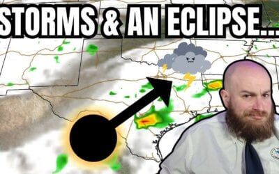

An eclipse for lunch and severe storms by dinner? Welcome to Texas weather in April. That appears to be on the agenda...
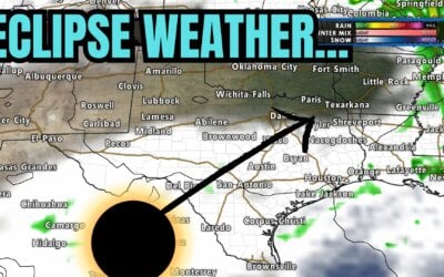
https://www.youtube.com/watch?v=MZYJZSo2TS0 All eyes are on the eclipse Texas weather forecast for Monday. We'll cover...
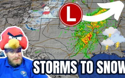
https://youtu.be/Z8BA50OrHg8 The past 24 hours have been marked by intense storm activity across various parts of...
The remainder of Saturday will feature pleasant weather across Texas. The...

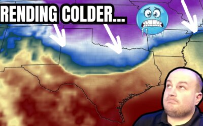
https://www.youtube.com/watch?v=O8oXrL7CxVE After two days of warmth, crashy the cold front has brought the arctic...
The following two days will feature warmer weather across most of Texas. Enjoy it, and use that time to prepare for a...
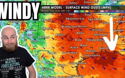
If a blizzard and a few tornado warnings weren't enough to occupy Texas's weather on Monday, the howling wind...
The next few days will take us up the temperature roller coaster before we plateau and head back down this weekend...
We have one more comparatively quiet weather day before Mother Nature throws us a fall severe weather event. It won't...
We interrupt the summer doldrums to bring a short-term disruption to the Upper Texas Coast. As usual for the summer...
We're back in a severe weather risk for the fourth or fifth Monday in a row. I do dislike Mother Nature when she gets...
It's April in Texas, so severe storms aren't unusual. Dealing with three Mondays in a row of severe weather chances?...
The threat of severe thunderstorms returns for our third Monday in a row. Tomorrow's severe weather threat does not...
Ingredients are coming into place to support a severe weather event tomorrow across the eastern half of Texas. We...
Severe thunderstorms are likely on Monday and Monday night in several regions of Texas. Compared to yesterday's...
Spring has just about sprung, and with that begins our primary severe weather season in Texas. Severe thunderstorms...
It's been a busy October in the severe thunderstorm department with multiple episodes of nocturnal squall lines. We've...
The National Hurricane Center has upgraded Nicholas to a minimum hurricane. Maximum sustained winds have increased to...
Tropical Storm Nicholas is nearing the Middle Texas Coast. The system's center is about 60 miles south of Port...
Tropical Storm Nicholas remains a sheared tropical cyclone. Yet again, the low-level center of the storm has reformed...