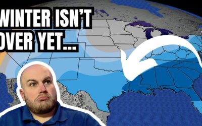
https://youtu.be/tZd6BxRdH_o A strong cold front will bring a little chill back to Texas this weekend with widespread...


https://youtu.be/tZd6BxRdH_o A strong cold front will bring a little chill back to Texas this weekend with widespread...

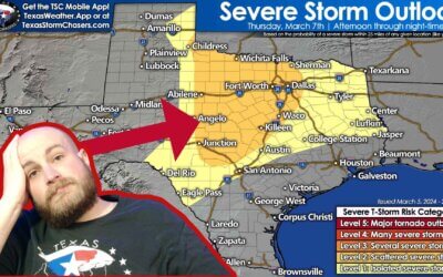
https://youtu.be/f0Z3y4lc-_0 Active weather returns to Texas for the remainder of the week. Today's scattered severe...

https://www.youtube.com/watch?v=czAhPxWGG0Q A few showers and storms with small hail are possible in the Ark-La-Tex...

A total solar eclipse followed by a two-day severe weather outbreak has made for a busy week across Texas. We have one...

Thunderstorms will be the name of the game in Texas today, with continued chances of large hail and flooding rains in...
April 8, 2024 #LIVE #Texas #Tornado coverage from Baldy-in-Chief David...
April 8, 2024 #LIVE #Texas #Tornado coverage from Baldy-in-Chief David...

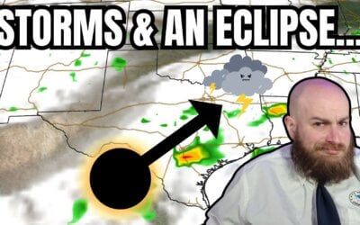
https://youtu.be/6sFEDoc8qbs The eclipse is hours away and clouds are moving north from the Gulf of Mexico. An...
Good evening! Here is a 9:30 pm update on tomorrow’s cloud cover potential...

https://youtu.be/inRPdmYrUk4 Texas is one day away from experiencing a generational event – a total solar eclipse....
A multi-faceted, multi-day severe thunderstorm and flooding event will follow an eclipse in Texas next week. The...
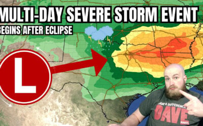
A multi-day severe storm event will follow an eclipse in Texas next week. Somehow, I figured Mother Nature wouldn’t...
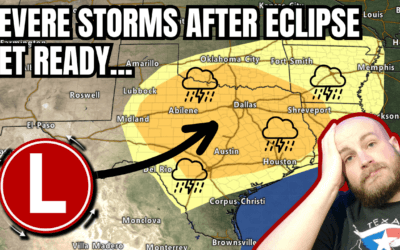
An eclipse for lunch and severe storms by dinner? Welcome to Texas weather in April. That appears to be on the agenda...
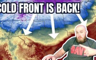
https://www.youtube.com/watch?v=Cm2fyVjlqqM A cool front has made its way across the northern half of Texas this...
The remainder of Saturday will feature pleasant weather across Texas. The...
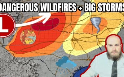
https://www.youtube.com/watch?v=rof7FfXZFag Today, we are facing a critical and dangerous situation as dangerous...
https://www.youtube.com/watch?v=tTbJNiXQO44 Thunderstorms are making a ruckus across the Ark-La-Tex and East Texas...
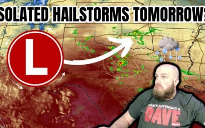
https://www.youtube.com/watch?v=aPvp5k91EQE Active spring-like weather is expected to influence Texas this week. The...
Yesterday will go down as a red-letter day in the history books of the Texas Panhandle with multiple, fast-moving...
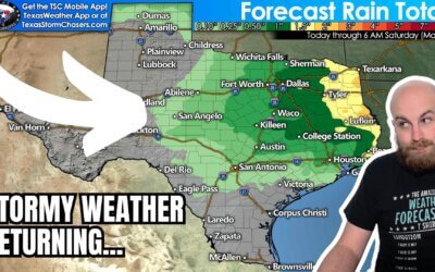
https://www.youtube.com/watch?v=k-556jVvsfE Rain chances return to Texas today, with more widespread precipitation...