https://youtu.be/4F1q4r6gfh0 Parts of Texas will start April off with a literal bang—with the possibility of severe...


https://youtu.be/4F1q4r6gfh0 Parts of Texas will start April off with a literal bang—with the possibility of severe...
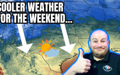
The remainder of Saturday will feature pleasant weather across Texas. The...
https://www.youtube.com/watch?v=uIPdPGlscOs The weather across Texas is about to play switcheroo regarding...
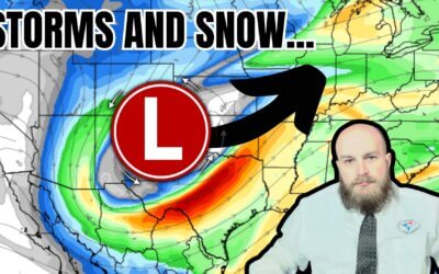
Storms and snow are forecast for Texas today. While it's unlikely for the two to coincide in the same location, we...

https://www.youtube.com/watch?v=IQiftGakwaI Active weather will lead to multiple chances for severe thunderstorms...
https://www.youtube.com/watch?v=g7-0kC-n6nY Tuesday afternoon brought isolated thunderstorms to portions of Texas....
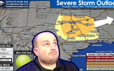
https://www.youtube.com/watch?v=tTbJNiXQO44 Thunderstorms are making a ruckus across the Ark-La-Tex and East Texas...

If the end of February indicates our upcoming summer, we might as well surrender. La Nina's return by the summer...
Well, yesterday sure was something. From fourteen inches of snow in Plainview on Interstate 27 to reported tornadoes...
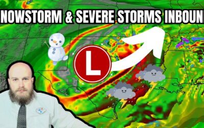
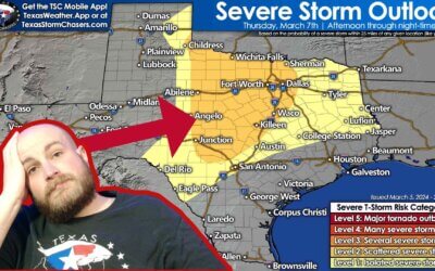
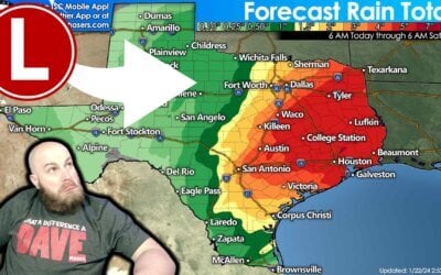
Impactful weather is expected across several regions of Texas over the next two days. Everything from a significant...
The weather across Texas will not be particularly pleasant for Super Bowl weekend. Rain is likely across the Edwards...

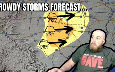
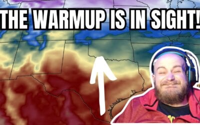
Warm weather will continue across most of Texas for the next few days, but changes are on the horizon with storms and...
https://www.youtube.com/watch?v=k-556jVvsfE Rain chances return to Texas today, with more widespread precipitation...
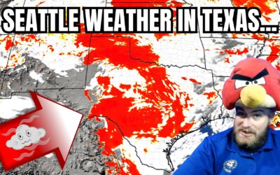
I don’t know about you, but I’ve grown tired of emulating Seattle. From all the wet weather to our nasty cold fronts,...
https://youtu.be/qk110NI0HW0?si=9oTqARq-O_ZEWvZB It has been a loud night for Texas's Central, South-Central, and...
https://youtu.be/0tSVbXbuCpM?si=nrXcFWm-XRozXqhd The worst of our latest arctic outbreak is behind us. We’re...

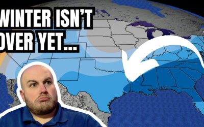
The summer of hell number two is behind us, and winter's wrath has returned to Texas. We’ve had periodic freezing...
Baldy-in-Chief David Reimer has a Sunday evening update on how long...
Do you remember those unpleasant times in July, August, and September when we wished for summer to end? Well, an...
Baldy-in-Chief David Reimer has an update on the arrival of an arctic cold front into Texas. We're also monitoring the...