https://youtu.be/Z8BA50OrHg8 The past 24 hours have been marked by intense storm activity across various parts of...


https://youtu.be/Z8BA50OrHg8 The past 24 hours have been marked by intense storm activity across various parts of...
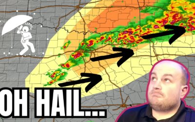
https://www.youtube.com/watch?v=j3zb6Mnekbo An isolated severe thunderstorm, potentially dangerous, is possible as...
Storms and snow are forecast for Texas today. While it's unlikely for the two to coincide in the same location, we...
https://www.youtube.com/watch?v=aPvp5k91EQE Active spring-like weather is expected to influence Texas this week. The...
Spring-like weather will continue across Texas through the remainder of the work week. A decent cold front will arrive...
Well, yesterday sure was something. From fourteen inches of snow in Plainview on Interstate 27 to reported tornadoes...
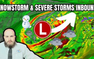
Impactful weather is expected across several regions of Texas over the next two days. Everything from a significant...

https://youtu.be/I-i_pQ8xL0M The whole #FalseSpring thing seems to have taken on a life of its own, as hashtags often...
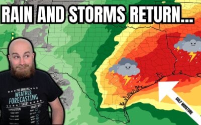
https://youtu.be/a9V9hAytA9U?si=hMGGJ3wMe9g7SPv8 This week, a warmer and wet weather pattern is setting up for a...

The summer of hell number two is behind us, and winter's wrath has returned to Texas. We’ve had periodic freezing...
The weather across Texas and much of the United States over the next week can be described as busy. An active weather...
Summer lovers...you have one more day to enjoy your heat and humidity before fall makes its first visit! Yes...we all...
Tropical Storm Nicholas remains a sheared tropical cyclone. Yet again, the low-level center of the storm has reformed...
Tropical Storm Nicholas is a disorganized cyclone this afternoon. After developing a defined surface circulation this...
Shortly after Jenny published her blog this morning, the National Hurricane Center initiated advisories on Tropical...
A large area of disorganized showers and thunderstorms which moved into the Bay of Campeche overnight is expected to...
A tropical wave continues to produce a large area of disorganized showers and thunderstorms in the southwest Gulf of...
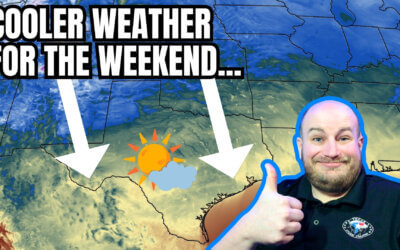
Our forecast for the weekend will be warm, mostly dry and seasonal throughout the state. Thanks to the "cool" front...
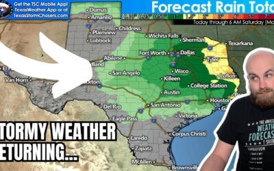
Rain chances will increase this weekend into next week across the southeastern half of Texas. We could be looking at a...
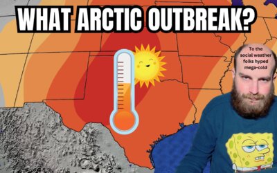
We've reached the top of our temperature roller coaster this week. After today, temperatures across Texas will either...