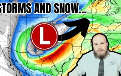
A multi-day severe storm event will follow an eclipse in Texas next week. Somehow, I figured Mother Nature wouldn’t...
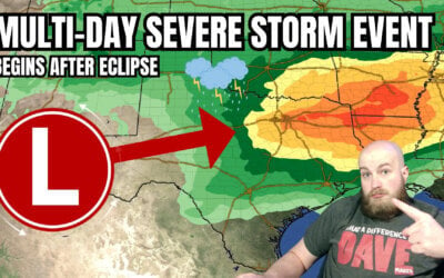

A multi-day severe storm event will follow an eclipse in Texas next week. Somehow, I figured Mother Nature wouldn’t...
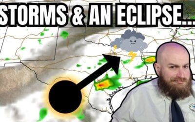
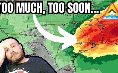
An eclipse for lunch and severe storms by dinner? Welcome to Texas weather in April. That appears to be on the agenda...
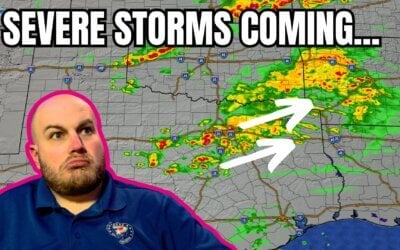
https://youtu.be/Z8BA50OrHg8 The past 24 hours have been marked by intense storm activity across various parts of...
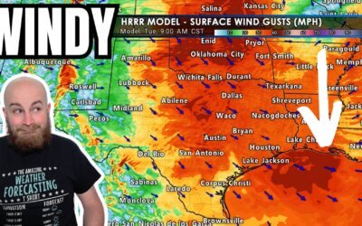
This afternoon, we've had multiple reports of brief tornadoes in the...
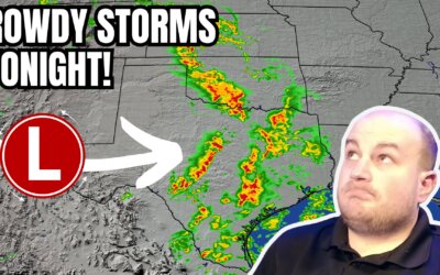
https://www.youtube.com/watch?v=j3zb6Mnekbo An isolated severe thunderstorm, potentially dangerous, is possible as...
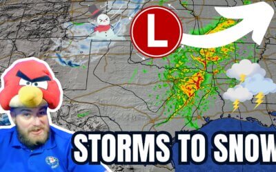
https://www.youtube.com/watch?v=uIPdPGlscOs The weather across Texas is about to play switcheroo regarding...
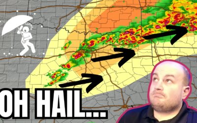
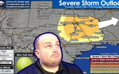
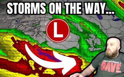
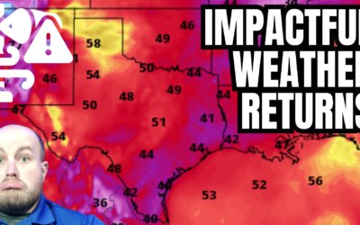
https://www.youtube.com/watch?v=IQiftGakwaI Active weather will lead to multiple chances for severe thunderstorms...
https://www.youtube.com/watch?v=aPvp5k91EQE Active spring-like weather is expected to influence Texas this week. The...
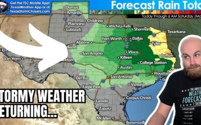
Spring-like weather will continue across Texas through the remainder of the work week. A decent cold front will arrive...
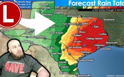
The weather across Texas will not be particularly pleasant for Super Bowl weekend. Rain is likely across the Edwards...
Spring-like weather this week will translate into spring-like thunderstorms tonight in Texas. A quick-hitting...
https://youtu.be/I-i_pQ8xL0M The whole #FalseSpring thing seems to have taken on a life of its own, as hashtags often...
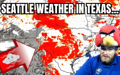
I don’t know about you, but I’ve grown tired of emulating Seattle. From all the wet weather to our nasty cold fronts,...
https://www.youtube.com/watch?v=aa4MKFfzWu4 There's a bit of ice, a bunch more rain, and a lot of fog – and that’s...
https://youtu.be/qk110NI0HW0?si=9oTqARq-O_ZEWvZB It has been a loud night for Texas's Central, South-Central, and...
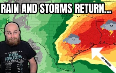
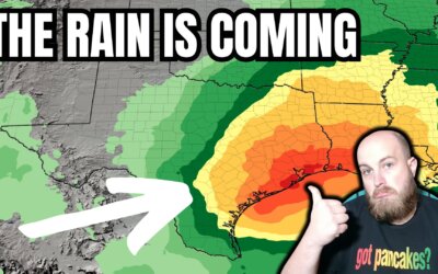
https://youtu.be/a9V9hAytA9U?si=hMGGJ3wMe9g7SPv8 This week, a warmer and wet weather pattern is setting up for a...
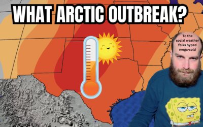
https://www.youtube.com/watch?v=O8oXrL7CxVE After two days of warmth, crashy the cold front has brought the arctic...

The summer of hell number two is behind us, and winter's wrath has returned to Texas. We’ve had periodic freezing...
If a blizzard and a few tornado warnings weren't enough to occupy Texas's weather on Monday, the howling wind...
It's a special Sunday evening edition of the Texas Weather Roundup, with an active Monday expected across Texas....