https://youtu.be/Z8BA50OrHg8 The past 24 hours have been marked by intense storm activity across various parts of...

https://youtu.be/Z8BA50OrHg8 The past 24 hours have been marked by intense storm activity across various parts of...
https://www.youtube.com/watch?v=j3zb6Mnekbo An isolated severe thunderstorm, potentially dangerous, is possible as...
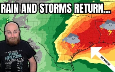
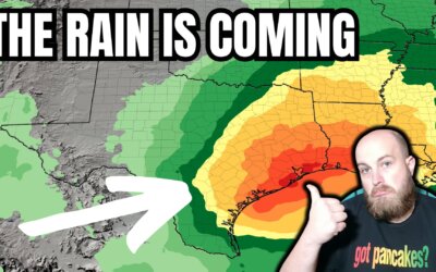
https://youtu.be/a9V9hAytA9U?si=hMGGJ3wMe9g7SPv8 This week, a warmer and wet weather pattern is setting up for a...
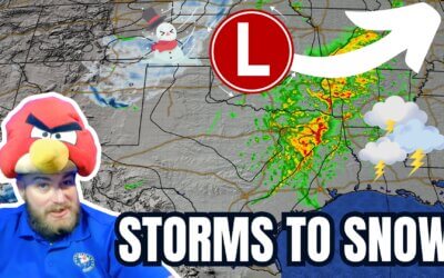
https://www.youtube.com/watch?v=O8oXrL7CxVE After two days of warmth, crashy the cold front has brought the arctic...
It's another late May day in Texas with a chance of afternoon and night-time thunderstorms. Today's severe weather...
An impactful day so far with multiple tornado warnings and flash flooding across parts of Texas. The threat for brief...
Coastal Bend/Coastal Plains A small cluster of thunderstorms extends from just north of Beeville to Kenedy to Nixon....
After an eventful end to March in the severe weather department, we've enjoyed a 'break' for the first week of April....
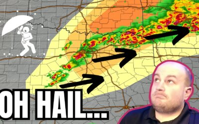
A severe thunderstorm watch has been issued for North Texas, Central Texas, and the Hill Country. The watch is in...
The much-advertised historic winter storm is underway this morning with conditions expected to deteriorate quickly by...
Download the Texas Storm Chasers Mobile App for free at https://texasweather.app/ Subscribe to @texasstormchasers...
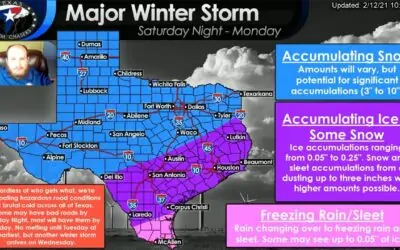
Key Messages (1) A historic winter storm is poised to Texas, with impacts beginning as early as Saturday morning,...
A messy night of freezing drizzle, freezing rain, and a bit of sleet can be expected across a large chunk of Texas...