https://www.youtube.com/watch?v=g7-0kC-n6nY Tuesday afternoon brought isolated thunderstorms to portions of Texas....

https://www.youtube.com/watch?v=g7-0kC-n6nY Tuesday afternoon brought isolated thunderstorms to portions of Texas....
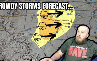
https://www.youtube.com/watch?v=tTbJNiXQO44 Thunderstorms are making a ruckus across the Ark-La-Tex and East Texas...
https://www.youtube.com/watch?v=k-556jVvsfE Rain chances return to Texas today, with more widespread precipitation...

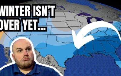
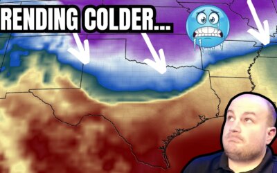
https://www.youtube.com/watch?v=O8oXrL7CxVE After two days of warmth, crashy the cold front has brought the arctic...

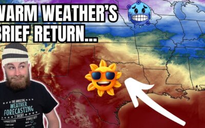
https://youtu.be/i68J4ZRJmNs I can see clearly now; the cold is gone! At least for today, as Texas heats up! That’ll...
https://youtu.be/KPzby0yXh3s Hip, hip, hooray, it’s Humpday! Not only are we halfway through the work week, but we’re...
The following two days will feature warmer weather across most of Texas. Enjoy it, and use that time to prepare for a...
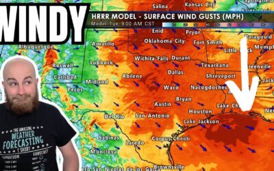
If a blizzard and a few tornado warnings weren't enough to occupy Texas's weather on Monday, the howling wind...
It's a special Sunday evening edition of the Texas Weather Roundup, with an active Monday expected across Texas....
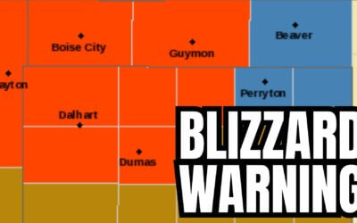
Here come the Blizzard Warnings for the NW Texas Panhandle for tomorrow. Avoid travel in the blizzard warnings and...

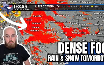
Dense fog this morning will slowly decrease in overall intensity through this afternoon. Sadly, some folks will remain...
All images and animations may be viewed full-screen by tapping on the image. That includes our mobile app, where...
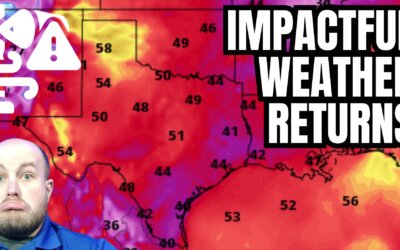
The weather across Texas and much of the United States over the next week can be described as busy. An active weather...
The next few days will take us up the temperature roller coaster before we plateau and head back down this weekend...

Two days ago, most weather model output showed a quick-hitting storm system exiting Texas by Thanksgiving. Since then,...
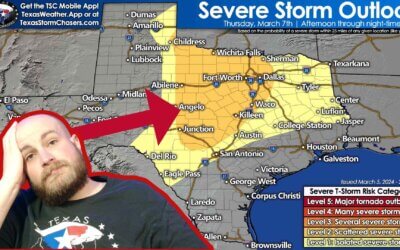
We have one more comparatively quiet weather day before Mother Nature throws us a fall severe weather event. It won't...
https://youtu.be/jhWza6k_3Bg After a downright chilly Wednesday morning, we're starting today several degrees warmer....
Happy Humpday, at least for those who work a Monday through Friday job. I know many folks have variable work...
The summer solstice isn't until June 21st, but Mother Nature has elected to throw summer our way early. This past...
Happy Memorial Day, and thank you to all those in the armed forces for your service. We wouldn't be storm chasing if...