
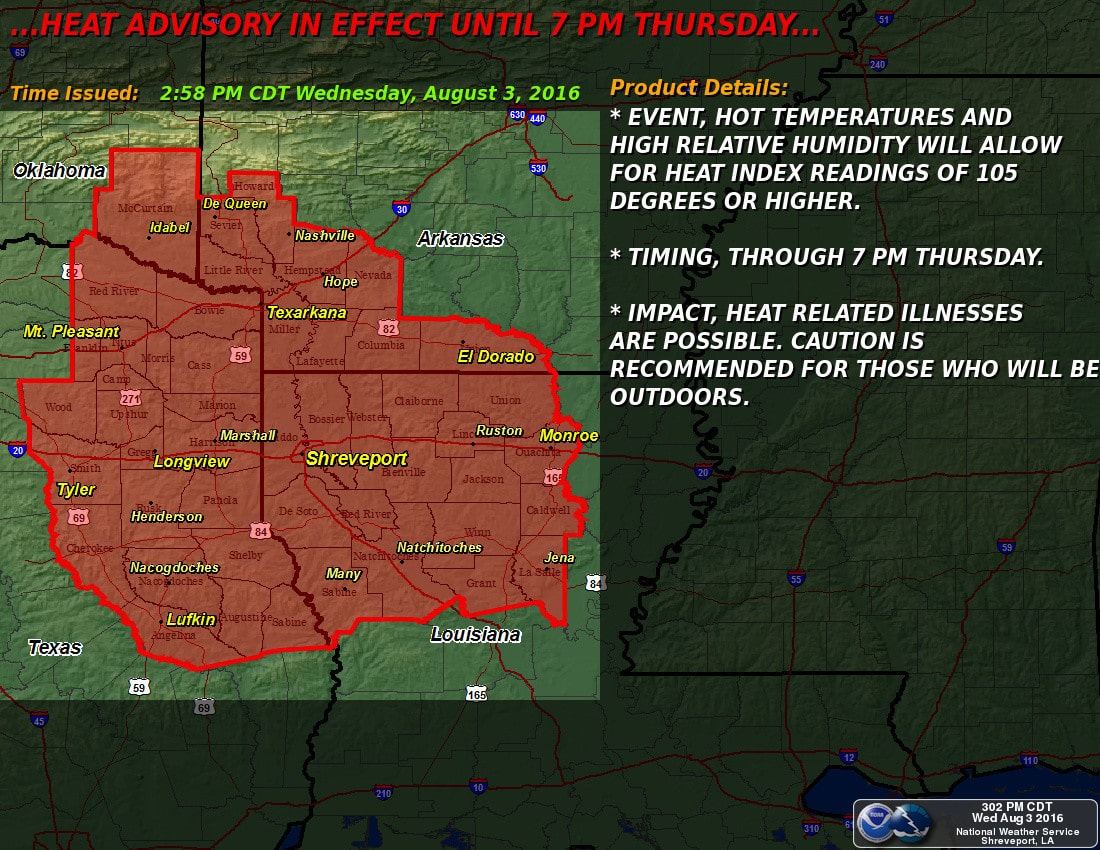
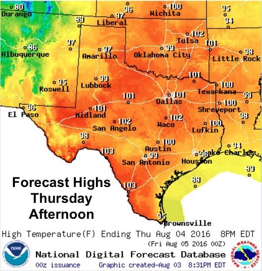
Heat Advisories east of the I-45 corridor in northeast and eastern Texas remain in effect through Thursday evening, and will likely be continued into Friday as well. With highs between 100 and 101 tomorrow, coupled with relative humidity values averaging in the mid 70s across this region, heat index values will rise to dangerous levels tomorrow afternoon…possibly as high as 108 to 110 near the Louisiana border. Unfortunately, there doesn’t seem to be much relief in sight through the weekend and into early next week. The ridge of high pressure will continue to remain the main weather feature for at least the next 5 days or so. After that, we may see some break in the heat on the eastern periphery of the ridge…at least that’s what the long range models are hinting at…but that remains to be seen. Suffice it to say, that’s not enough to get your hopes up just yet.
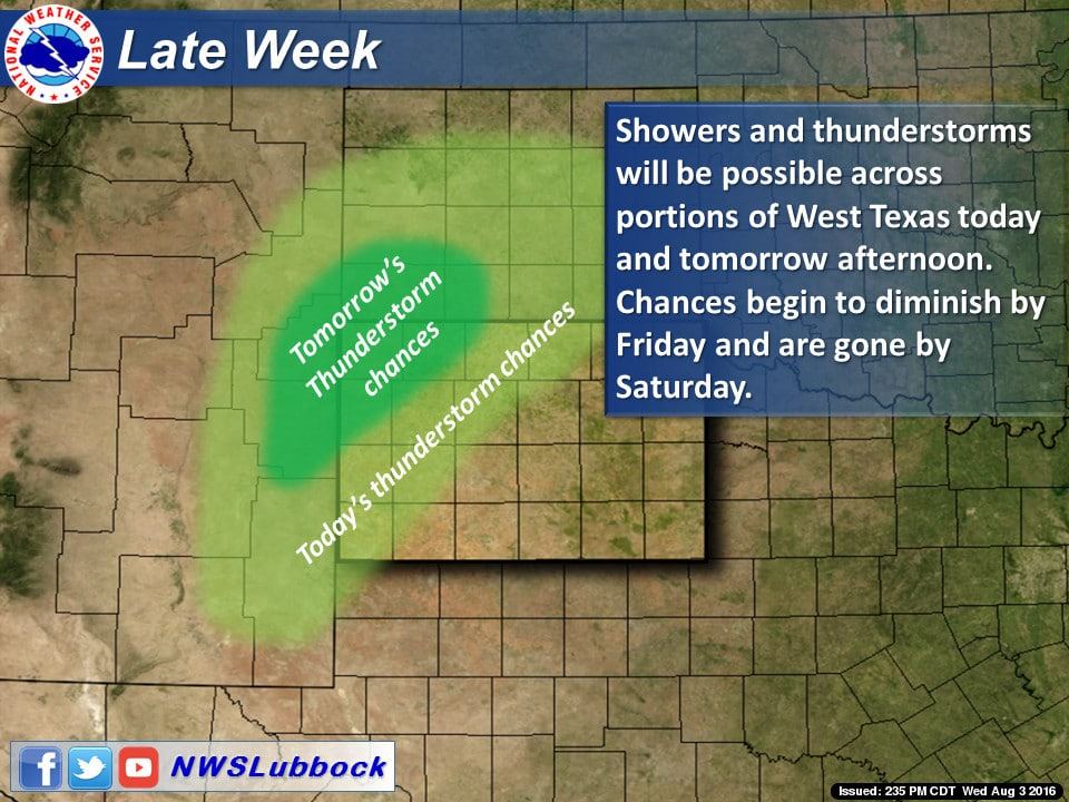
Rain chances continue to be few and far between. Monsoonal moisture across New Mexico and far western Texas has lead to the development of afternoon showers and storms for the past several days, but that too will be decreasing as we head into the weekend and the ridge expands further west shunting the monsoonal moisture further west as well. What can we say, it’s that time of the year when sitting in front of a fan with your favorite ice cold beverage transitions from luxury to necessity!


0 Comments