
The forecast today and through the work week will continue to be hot and mostly dry as a ridge of high pressure continues to influence weather across the state. Chances for rainfall will be best along its periphery…west Texas and the panhandle region as monsoonal moisture increases this week…eastern Texas where daily pop-up showers are possible…and coastal areas where the daily seabreeze will continue to bring chances for afternoon showers. As we all know, this type of hot and stagnant (boring!) weather is not unusual for this time of the year. But we also know that it will not last forever, and eventually we’ll be looking at cooler and wetter weather on the horizon. And we just might get that this coming weekend with a chance for seeing a cold front make its way into northern Texas bringing rain chances along with it!
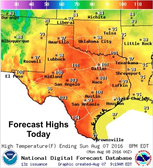
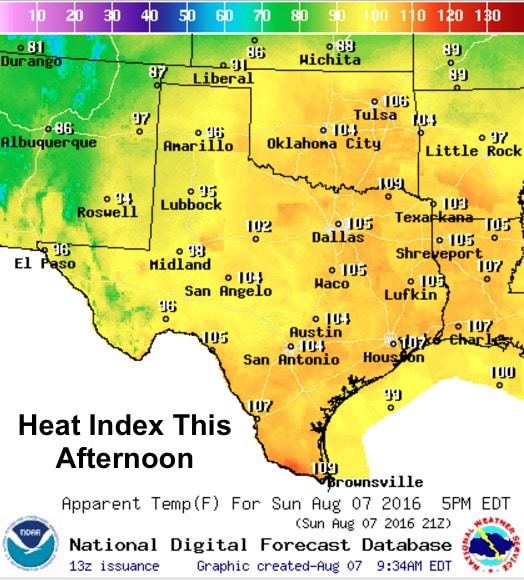
For today…hot with a chance of more hot. Heat Advisories remain in effect through this evening across much of north central Texas, including the Dallas/Ft. Worth metro area, northeast and eastern Texas with heat index values this afternoon between 105 and 108. The Brownsville area will also be tackling the same conditions with heat index values topping out around 109. Best to get any outdoor chores done early on in the day, or wait until late evening.
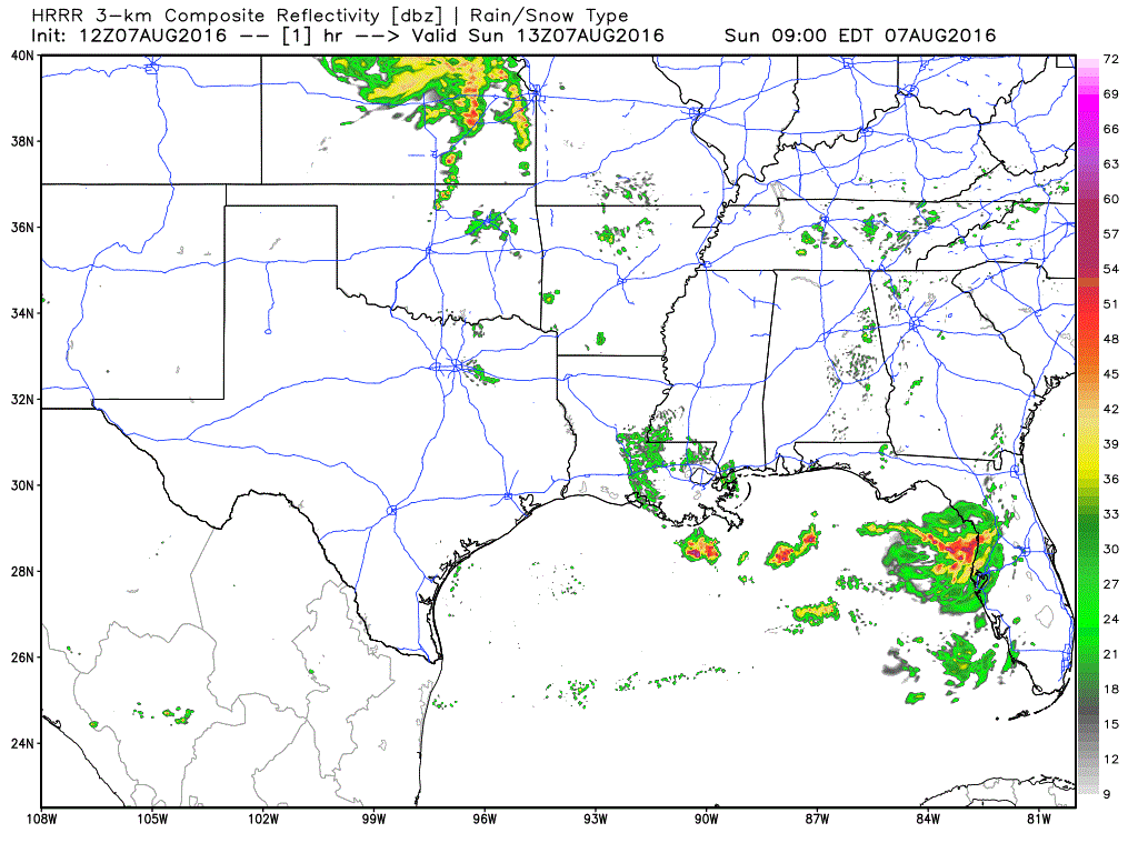
Short range model forecast for today
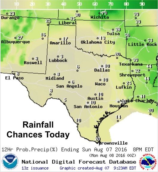
Rainfall chances today will be best across the panhandle and far western Texas with monsoonal moisture continuing to flow over the region. Coastal showers will remain possible during the early afternoon hours as well as pop up showers across far east Texas into Louisiana. Pretty much the same scenario we’ve seen over the past couple of days and will continue to see into the work week.
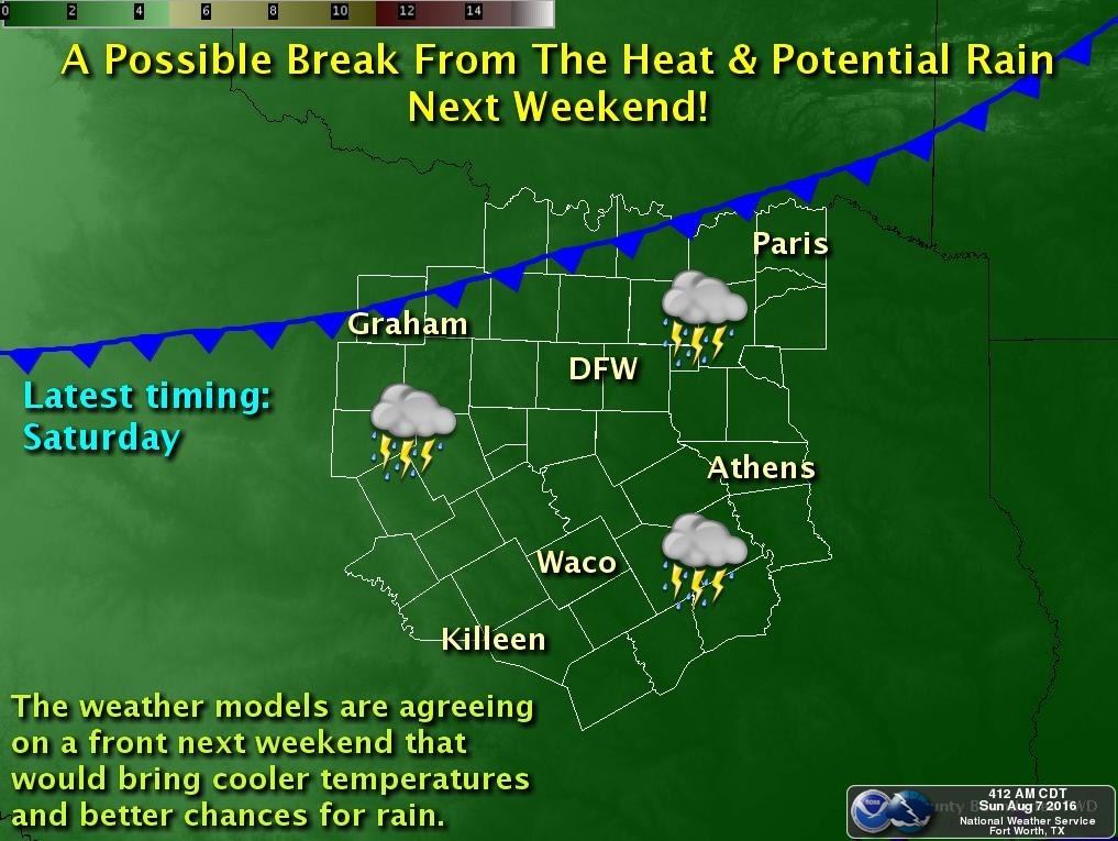
As mentioned above, we are looking at a decent chance for seeing a cold front drop down into north Texas by next weekend! If this materializes as currently forecasted, we’ll be looking at rain chances next Saturday and Sunday across the region as well as a temporary break from the heat. Unfortunately, it looks like the front will stall out somewhere across central Texas and will not bring much relief to hot conditions across the southern half of the state, but we’ll keep monitoring this development and bring you the latest as we get through the week ahead!


0 Comments