
How about that heat yesterday afternoon? D/FW Airport topped out at 100 degrees. That barely missed making the top 10 list for the latest triple digit reading at the airport, but it was annoyingly hot regardless. We saw heat index values climb up above 105 degrees along and east of Interstate 35 yesterday. We even had a few popup storms because the hot temperatures busted through the cap! Who else is ready for fall?
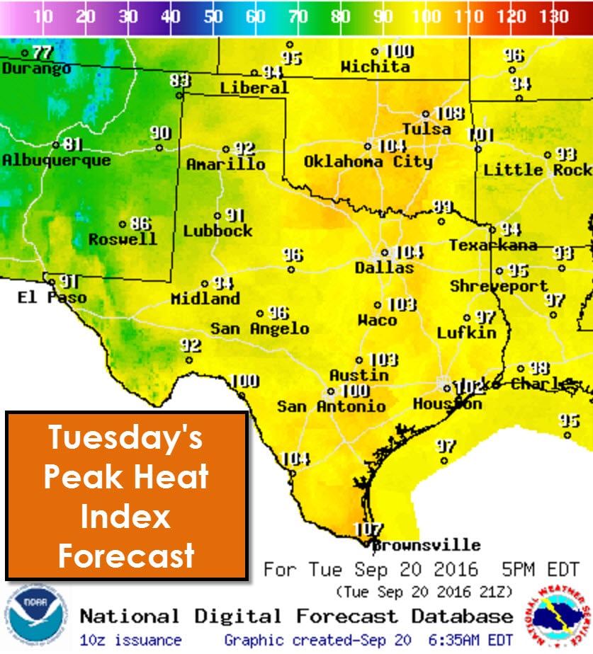
It is going to be another hot one today, but we should be a few degrees lower than what we ended up seeing on Monday. That doesn’t help too much when heat index values are above 100 degrees, but I suppose we’ll take what we can get. This afternoon’s heat index values will top out near or in the triple digits east of Highway 281 – or from 50 miles west of Interstate 35 and all points east. Slightly lower humidity values should keep heat index values below the 107-112 degrees some folks hit yesterday. Temperatures and associated heat index values will top out in the upper 80s to 90s in the western half of Texas. These values are all above average for late September, but we shouldn’t be breaking too many records today.
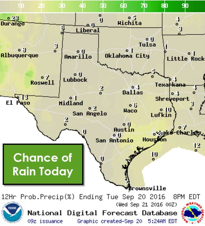
A rogue storm can’t be ruled out in Southeast Texas, the Middle Texas Coast, or in the Borderland this afternoon. By far rain chances will be near zero across all of Texas this afternoon. Any popup storm that does manage to develop could produce locally gusty winds before dissipating by 7-8 PM.
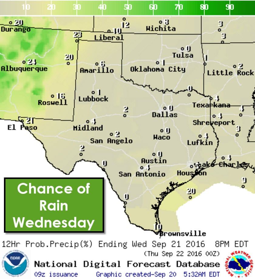


Rain chances will stay low on Wednesday and Thursday but we will see an increase on Friday as moisture starts to advect northward from the Gulf of Mexico. The best chance for scattered storms on Friday will in in Southeast Texas, the Middle Texas Coast, inland into the Brazos Valley and South-Central Texas. Isolated storms will be possible in the Borderland.
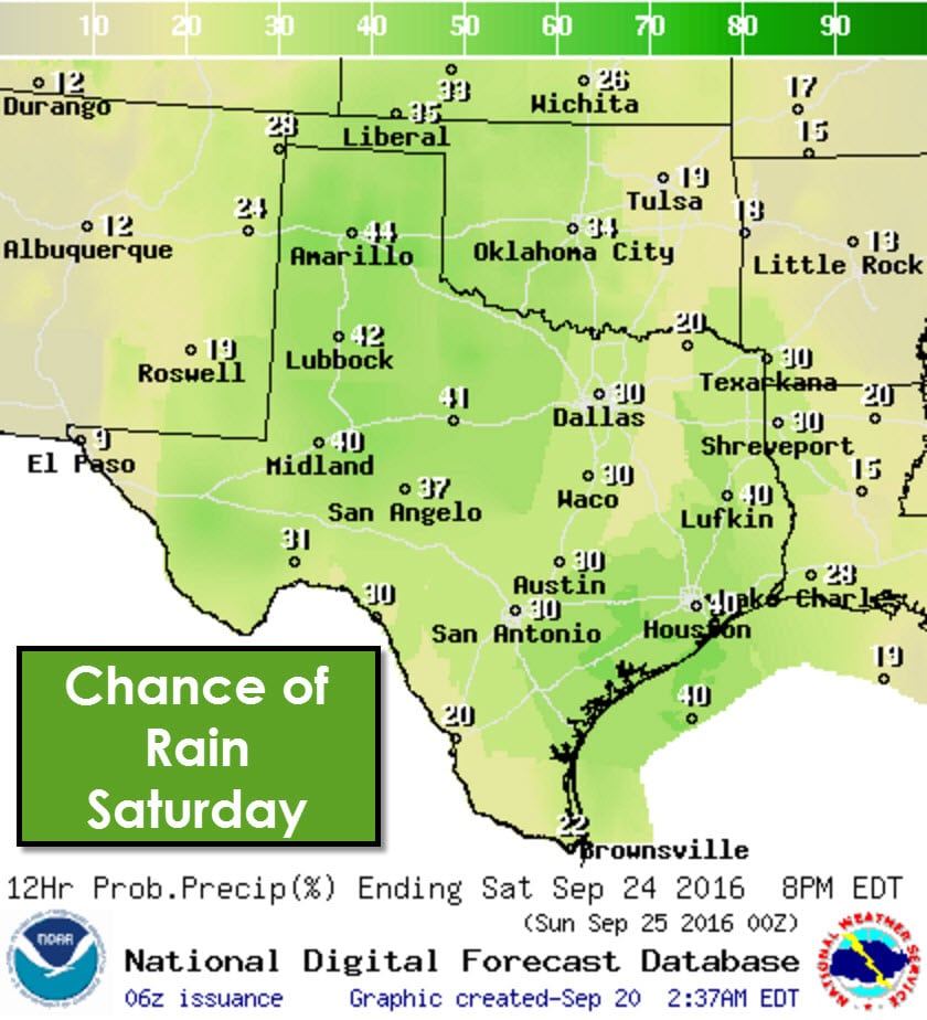
Rain chances increase statewide on Saturday as we undergo a pattern change. These rain chances could change depending on the storm system’s timing and overall strength. Expect rain chances to continue and potentially increase on Sunday and into next week.
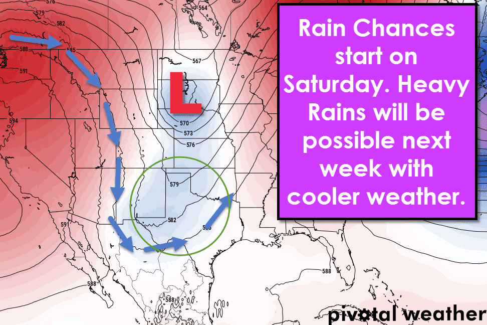
As mentioned above we’ll be undergoing a pattern change by Saturday. The area of high pressure aloft will shift into the southeastern United States. Replacing it will be a trough digging in and helping to bring increased rain chances and cooler weather. This slow-moving system could bring several days of rain chances to Texas, some of which could be heavy. A decaying pacific hurricane could also bring more moisture into parts of Texas, helping to enhance rain chances. The timing aspects of this system will likely change since we’re still dealing with a system several days away. Regardless, rain chances and cooler weather should arrive by the end of this weekend.


0 Comments