
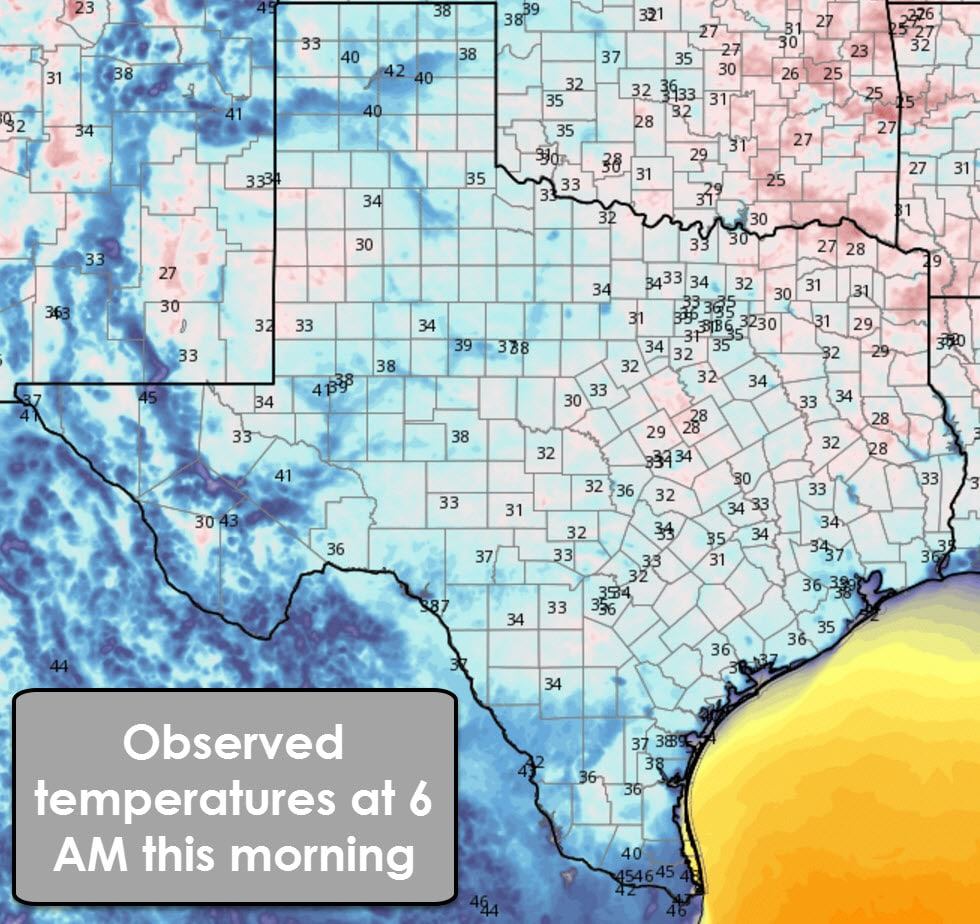
Temperatures have warmed nicely this morning after bottoming out in the upper 20s to lower 40s overnight. This morning’s seasonably cool weather will give way to warmer temperatures for the next couple of days. Our next cold fronts will arrive on Tuesday/Wednesday and Saturday/Sunday. Thanksgiving’s weather is looking great for Texas!
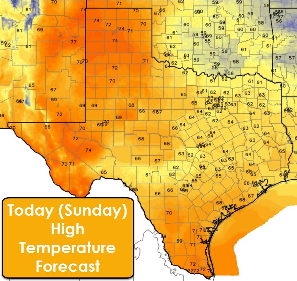
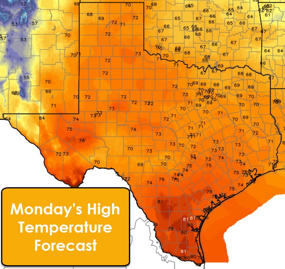
After a couple days of cooler weather a southerly flow has firmly reestablished itself across Texas. High temperatures this afternoon will be noticeably warmer across the Texas Panhandle into Permian Basin and Rio Grande Valley with low to middle 70s. The remainder of the state will continue to enjoy high temperatures in the 60s. The warming trend will continue on Monday and Tuesday with high temperatures in the middle to upper 80s across South Texas and 70s elsewhere. Our next cold front will start pushing south into Texas on Tuesday with high temperatures dropping back into the 50s and 60s behind it. Cooler weather, but still quite nice, will arrive for Wednesday, Thursday, and Friday. Another storm system arriving next weekend could bring another cool down.
Moisture values will be increasing across the eastern half of Texas today and on Monday as southerly winds pump it back inland from the Gulf of Mexico. On Tuesday scattered showers and thunderstorms will be possible in Northeast Texas, East Texas, North Texas, Central Texas, into the Brazos Valley and Middle Texas Coast. Most of this activity should be on the lighter side during the day Tuesday. An uptick in both intensity and coverage of thunderstorms is anticipated Tuesday Night from near Interstate 35/35E east into the Middle Coast, Brazos Valley, Northeast Texas, East Texas, and Southeast Texas. A few storms may be strong to severe during the evening and overnight hours Tuesday. Please see the discussion on severe and heavy rain potential below. Rain chances will end from west to east on Wednesday.
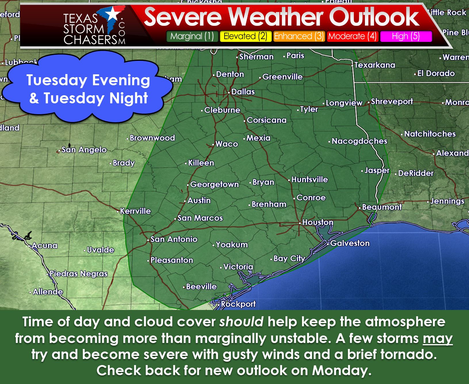
The Storm Prediction Center has placed most of Central Texas, North Texas, Northeast Texas, East Texas, Southeast Texas, the Brazos Valley, and the Middle Coast in a marginal risk of severe thunderstorms for Tuesday and Tuesday Night. A marginal risk is a category one in a five category system – one is the lowest. Future outlooks may introduce a small category 2 risk – the standard risk level – in parts of Central and Southeast Texas. Widespread cloud cover during the day Tuesday and a cap should keep a lid on intense thunderstorms. It is not out of the question that a few storms try and intensify during the late evening hours Tuesday into Wednesday morning. The atmosphere will be marginally unstable but wind shear values will be strong. If any storms were able to become low-topped supercells they could produce localized gusty winds up to 60 MPH and perhaps a brief tornado. This risk is highly conditional on those more intense storms even occuring – which isn’t a high probability based on the current model data. Check back on Monday for the new outlook. We should have a better grasp on if we could actually have a severe storm threat develop.
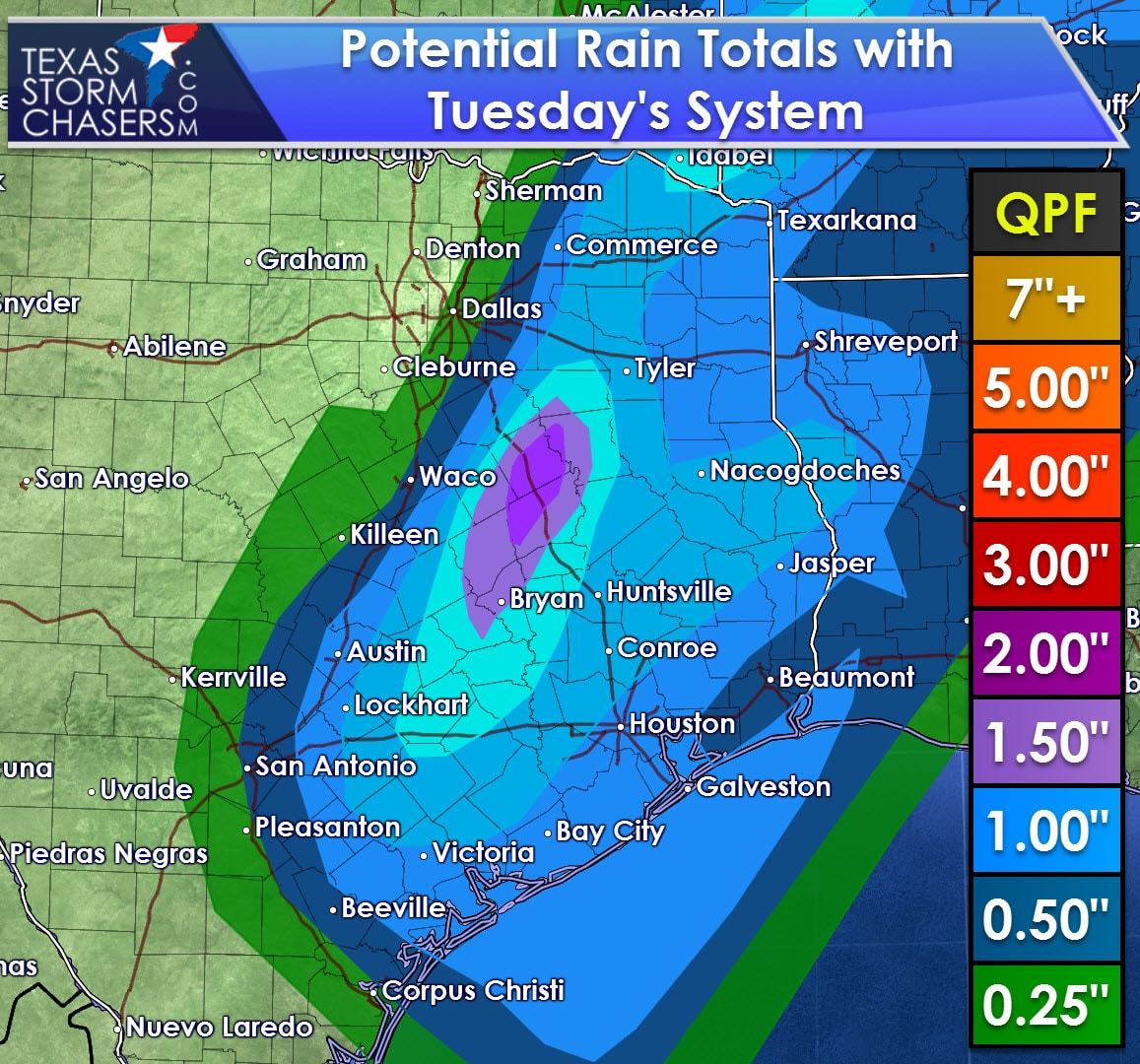
A vast majority of rain chances with the Tuesday system will be east of Interstate 35. If the system slows down a bit we could see some of those drawn back to the west of I-35. Regardless a flood event is not anticipated at this time. Widespread rain totals on Tuesday Evening through Wednesday Afternoon could range from 1 to 2 inches. Very localized, minor flooding could occur if a heavy storm dumps a quick inch or two of rain in an hour, but these forecasted totals are not high enough to produce widespread or moderate/major flooding.


0 Comments