
Little in the way of active weather is anticipated until our next storm system arrives on Friday. Precipitation chances will increase across the western two-thirds of Texas through the day as showers develop. Those precipitation chances will increase Friday night with a good soaking through early Sunday. Scattered showers will remain possible through Monday. Severe weather is not expected as the airmass will be far too stable for severe weather. It’ll be a chilly Saturday and if you’re attending any outdoor events plan on taking rain gear and a good jacket.
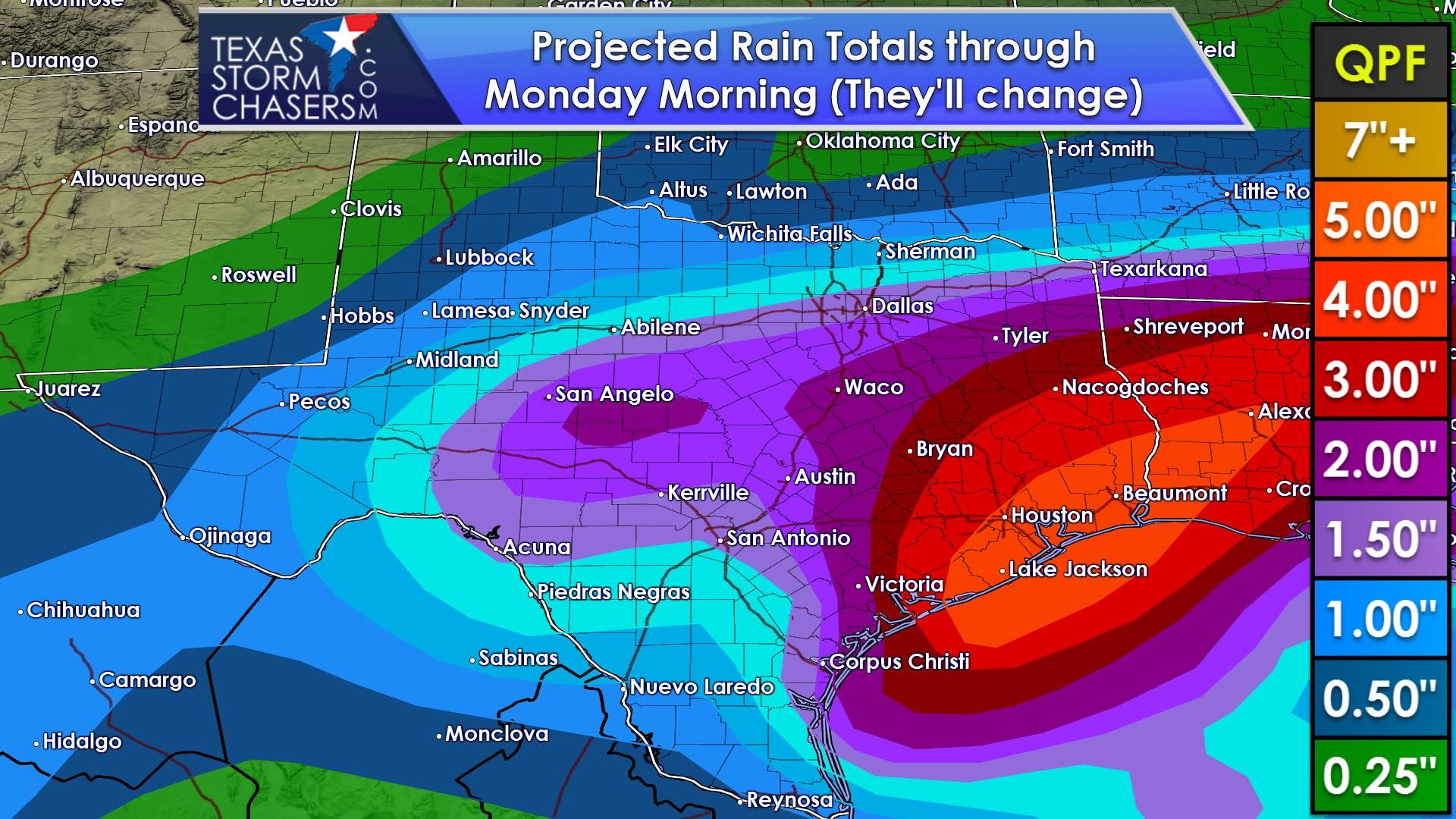
Most rain this weekend won’t be overly heavy, but it will be widespread. As a result multi-day rain totals will tend to range from half an inch up to two inches across all of Texas except the Texas Panhandle. The Panhandle will see lighter totals, but could also see some of the precipitation fall as snow on Friday and the first half of Saturday. Heavier totals may occur in Southeast Texas near the coast, but that potential for locally heavier rain will be refined once we get into Thursday night.
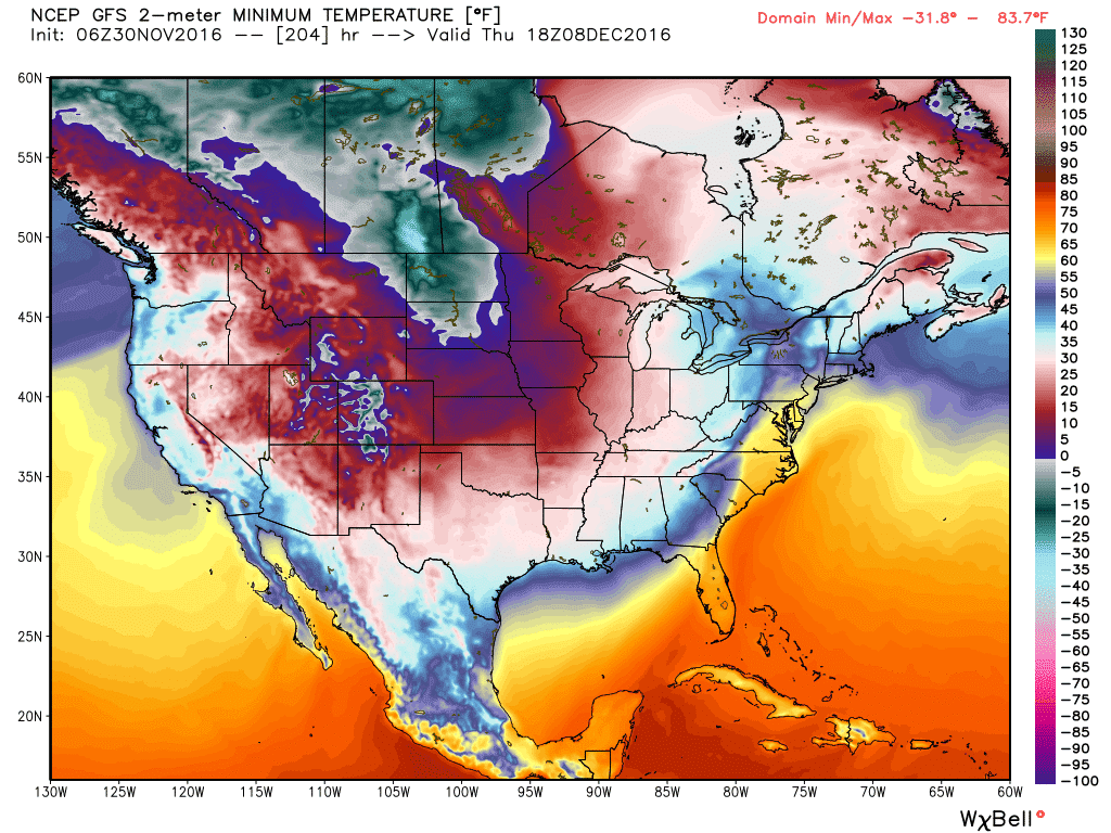
Meanwhile an arctic airmass will invade much of the United States next week. A polar cold front will move south into Texas on Wednesday into Thursday of next week. High temperatures look to range from the 30s to 40s with lows in the 10s, 20s, and 30s. All of this could change, but that airmass would be colder than anything we saw last winter.


0 Comments