
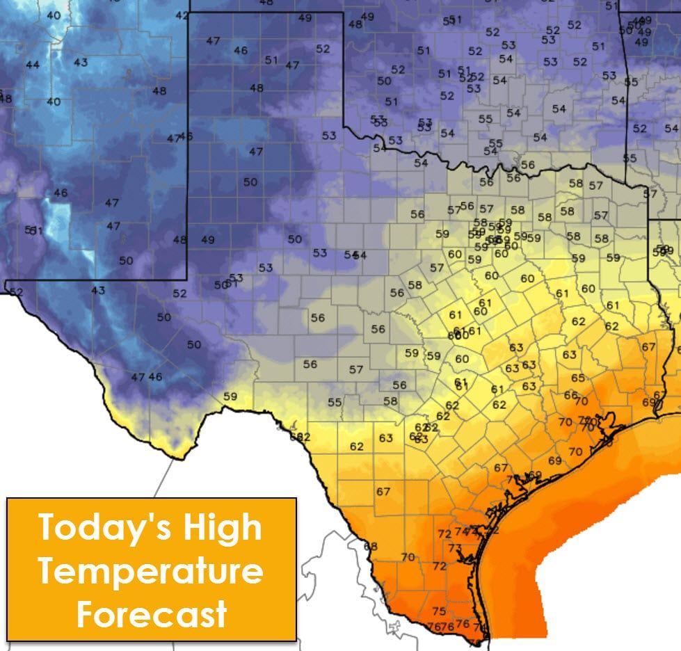
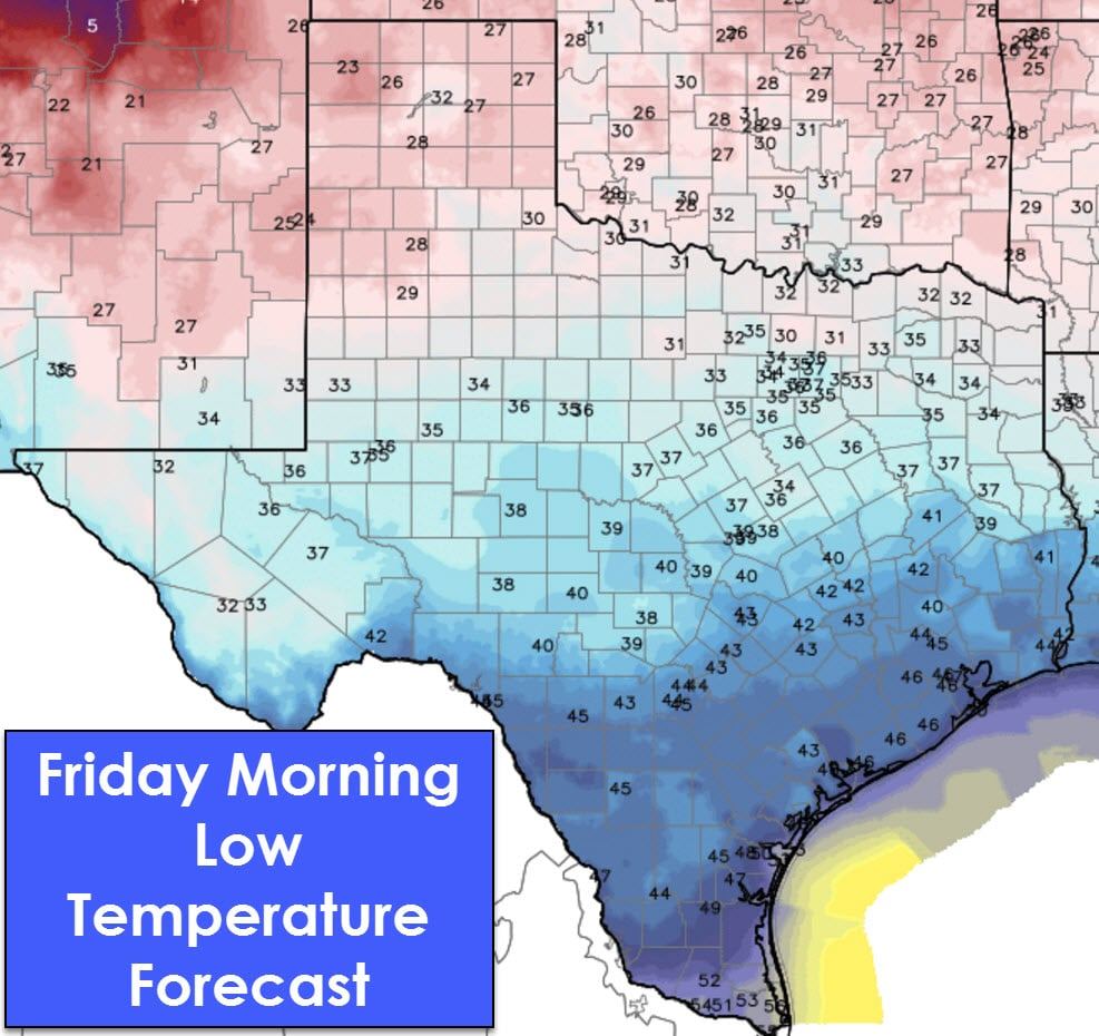
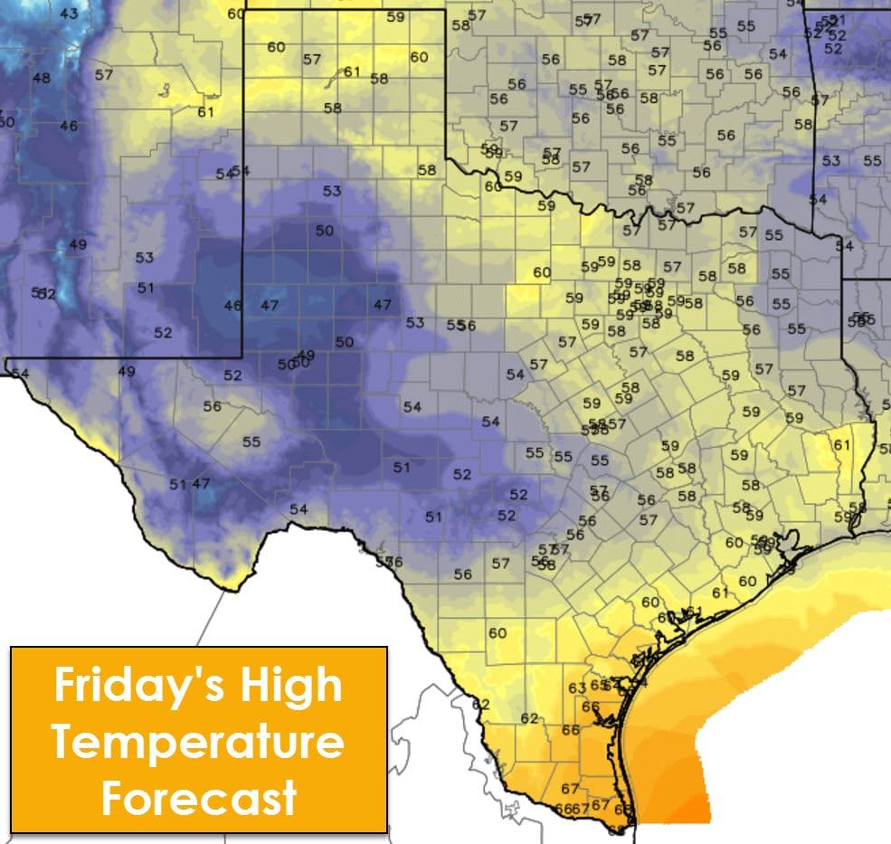
The next two days will feature cooler temperatures compared to those experienced on Wednesday. The cooler of the next two days will be on Friday with high temperatures in the upper 40s in the Alpine area up through West Texas. 50s to 60s can be expected across the remainder of Texas on Friday. These temperatures are near seasonal averages and much warmer than what we’ll be dealing with this time next week.
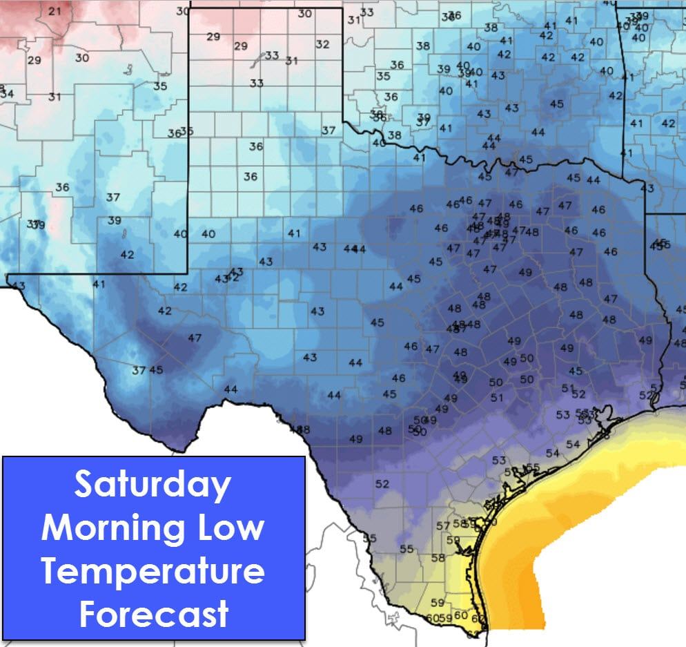
We’ll head back up the temperature roller coaster on New Years Eve into New Years Day (Saturday and Sunday) with high temperatures in the 60s and 70s across most of Texas. The exception to that will be in the Panhandle where cold air advection will keep temperatures in the 40s on Saturday. Warm air advection on Sunday will bring warmer temperatures back to the Panhandle. We’re not looking at any arctic air until Tuesday/Wednesday.
Scattered showers will be possible Friday Night across South-Central Texas into the Brazos Valley, Southeast Texas, East Texas, and Northeast Texas. By Saturday we expect showers and a few storms to become fairly numerous across East Texas and Southeast Texas. There is the potential for locally heavy rainfall during the day Saturday before the heaviest activity moves east into Louisiana. Severe thunderstorms are not expected at this time with the highest instablity values remaining off-shore. BY the evening hours Saturday (New Years Eve) a few showers will remain possible in far East Texas and Southeast Texas. The remainder of Texas should be dry with temperatures in the 40s and 50s. It may be cooler in the Texas Panhandle and West Texas. Scattered showers will remain possible on New Years Day (Sunday) in East Texas and Southeast Texas.
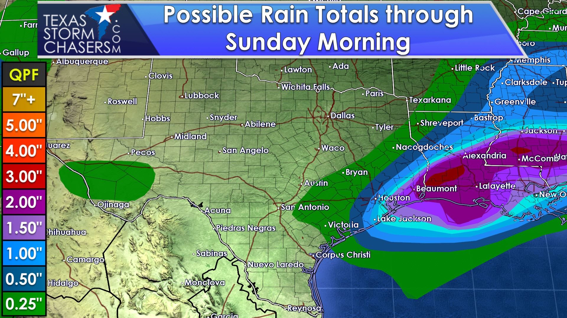
Rainfall amounts from Friday through Sunday morning will be highest in far Southeast Texas where up to two inches of rain may fall. It is not out of the question that locally higher rainfall amounts occur with isolated flooding. Rainfall amounts quickly drop off to around a quarter of an inch in the Brazos Valley west through South-Central Texas into Southwest Texas.
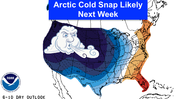
An arctic outbreak is expected to invade Texas in the Tuesday to Wednesday timeframe of next week. Temperatures will be similar to those experienced during the last very cold event about two weeks ago. That means we’ll see low temperatures range from the single digits to twenties with some locations struggling to get above freezing during the later half of next week. Weather models are indicating the potential for a storm system to impact parts of Texas around Thursday of next week. Should that occur there is the potential for winter precipitation. I stress to you that accuracy in predicting specifics in storm track’s and overall impacts is very low at that range. I would not be surprised if the storm system ends up impacting Kansas and Oklahoma versus Oklahoma and Texas. Regardless, the second half of next week is looking interesting in the weather department. Stay tuned!


0 Comments