
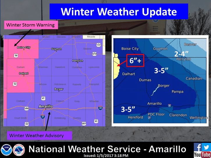
The forecast of snow in Texas generally will get the most attention from the public, but it won’t be the main weather issue through Saturday. Dangerously cold temperatures are now forecast on Friday into Saturday morning. We’ll get to that in just a moment, but a quick word on the ongoing snow in the Texas Panhandle. We will continue to see snow increase in coverage and intensity from west to east through the late evening hours. I do expect roads to become snow-covered and slick fairly rapidly due to temperatures in the teens. Don’t expect much improvement on road conditions on Friday with high temperatures struggling to get above the single digits. Three to six inches of snow will be possible, with locally higher amounts. That heavier snow band will then move east into Oklahoma. Little snow is expected in Northwest Texas east through Texoma.
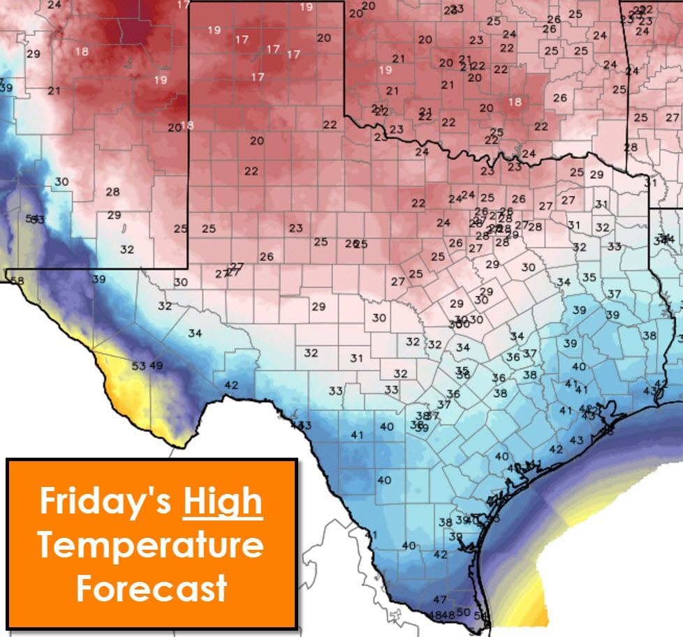
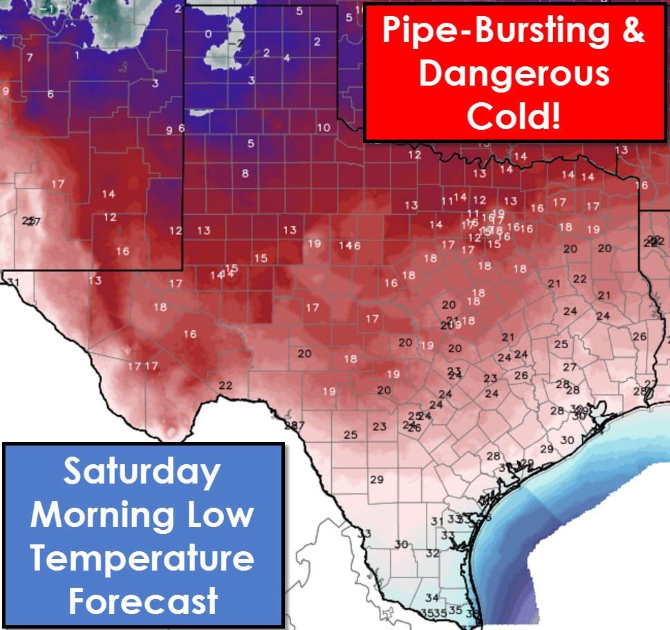
High temperatures will not get above freezing on Friday if you’re north of the Permian Basin, Hill Country, Central Texas, into Northeast Texas. Midland, San Angelo, D/FW, to Paris will all remain in the 20s on Friday with wind chills in the 0s/10s. Dangerously cold temperatures are expected by Saturday morning as skies clear, winds relax, and we see excellent radiational cooling commence. Temperatures below zero are possible in the Texas Panhandle where a snow cover will be present. Lows in the teens are expected as far south as the Hill Country through Central Texas into parts of East Texas. The freezing line will push into Deep South Texas. Only a sliver of the Rio Grande Valley may escape a freeze Friday night. With temperatures in the 0s to 20s across a large part of Texas by Saturday morning we encourage you to take cold weather precautions. Remember your pipes, pets, neighbors, and plants.


0 Comments