
The Storm Prediction Center has issued a new tornado watch for portions of East and Southeast Texas. This watch runs south of a Nacogdoches to Center line and runs south all the way to the coast. Lufkin, Pineland, Woodville, Jasper, Newton, Kirbyville, Lumberton, Beaumont, and Port Arthur are included in this watch. I do believe the highest threat for severe weather, including the threat for a couple of tornadoes, will be along and south of a Woodville to Newton line, but strong winds are certainly possible throughout the watch zone. Have a way to receive severe weather warnings and move to the safe place as the line of storms approaches.
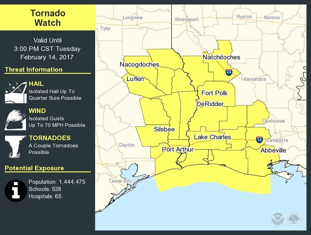
Tornado Watch Number 33
NWS Storm Prediction Center Norman OK
940 AM CST Tue Feb 14 2017
The NWS Storm Prediction Center has issued a
* Tornado Watch for portions of
Southwest Louisiana
Southeast Texas
Coastal Waters
* Effective this Tuesday morning and afternoon from 940 AM until
300 PM CST.
* Primary threats include…
A couple tornadoes possible
Isolated damaging wind gusts to 70 mph possible
Isolated large hail events to 1 inch in diameter possible
SUMMARY…A line of strong to severe thunderstorms will track across
the watch area late this morning and early afternoon, posing a risk
of damaging winds and a tornado or two.
The tornado watch area is approximately along and 90 statute miles
north and south of a line from 50 miles northwest of Port Arthur TX
to 50 miles east northeast of Lake Charles LA. For a complete
depiction of the watch see the associated watch outline update
(WOUS64 KWNS WOU3).


0 Comments