
A relatively fast-moving upper level storm system will bring a chance of very light rain to portions of South-Central Texas, the Brazos Valley, and Southeast Texas late tonight through parts of Friday. The lower-levels of the atmosphere are dry, so most falling precipitation will evaporate before reaching the ground. Some folks may pick up a couple hundredths of an inch of rain, but no big deal whatsoever. Saturday will be dry across Texas before we gear up for what will be a much more impactful storm system.

An area of upper level low pressure will move onshore Saturday in far southern California. This low pressure system will move southeast into northern Mexico on Sunday. By Monday the low should be a couple hundred miles west/southwest of Eagle Pass and Del Rio. This positioning of the low will place the eastern half to eastern two-thirds of Texas in a favorable position for lift – and precipitation.
Moisture values will rapidly increase on Saturday. By Sunday we should see copious amounts of moisture available for precipitation. Plentiful moisture from the Gulf along with mid-level moisture from the Pacific will set the stage for a widespread rain/thunderstorm event. Confidence is moderate that this event will start during the day Sunday and continue into Monday and Tuesday. Obviously it’ll start out first in western sections of the threat zone – and end last in the eastern sections. Sunday and Monday look to be the two greatest days and nights for precipitation potential.
The upcoming setup does have the potential to produce a few strong to severe storms on Sunday in the Concho Valley and parts of the Hill Country. Spotty hail and localized damaging winds look to be the main threat if we can get a few stronger storms to fire up. We’ll ascertain the severe weather threat for Sunday once we get into Friday and Saturday.
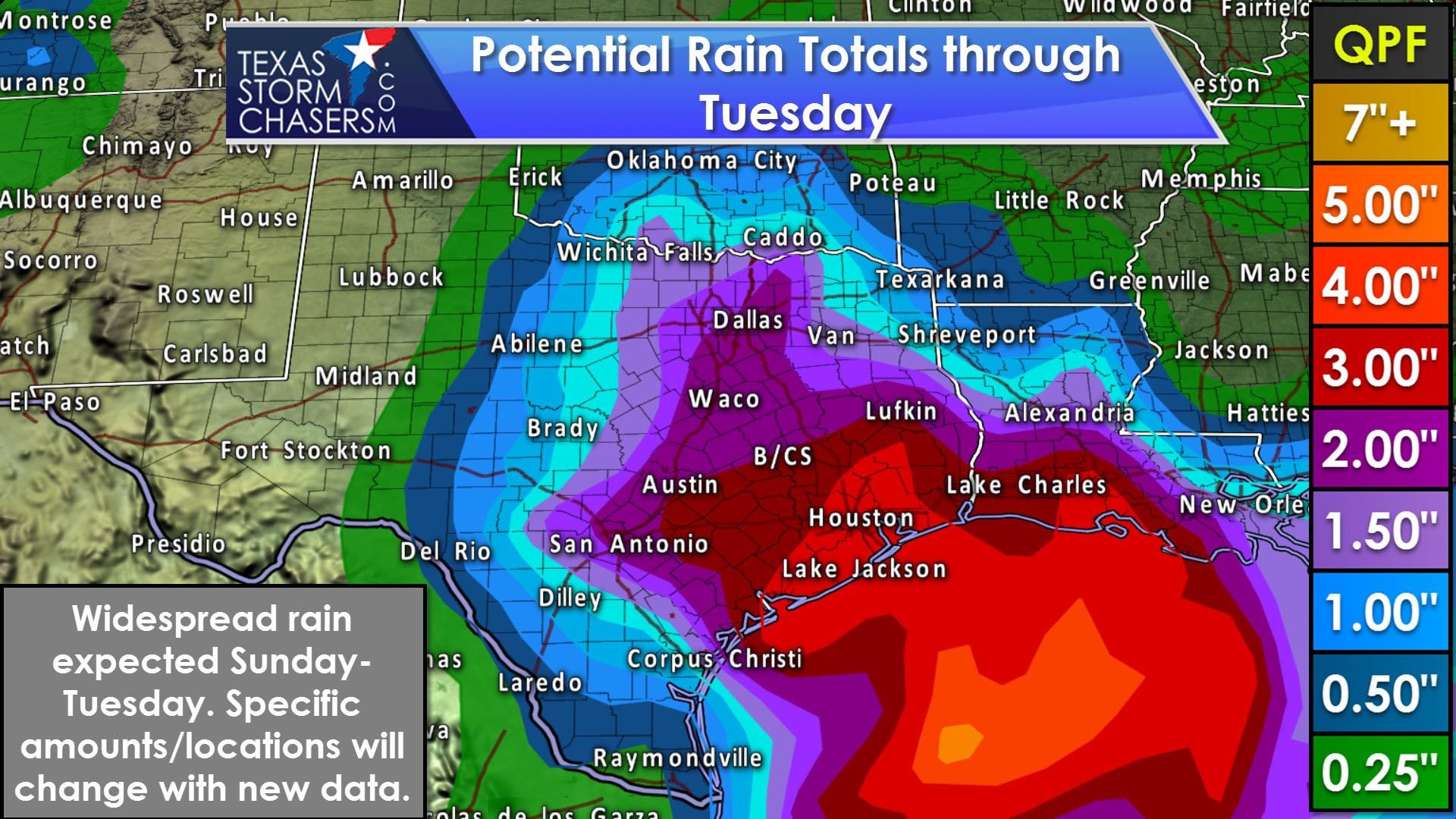
What will undoubtedly be the primary weather impact is the potential for widespread moderate to heavy rain across the eastern half of Texas. It looks like we should see a fairly large swath of one to three inch rain accumulations by the time this event winds down on Tuesday. Localized amounts of four to six inches are possible in southern sections of East Texas, Southeast Texas, and the Hill Country. Training thunderstorms (or storms that just keep moving over the same areas like they’re on a train track) will be a concern. Those training cells would likely be the ones to produce the heaviest rains over a localized area. Some flooding threat may develop, but the specific threat areas will have to be pinned down once we’re closer to the event. We need the rain, so that’s the good news.


0 Comments