
Since we’ve had severe weather issues on several of the past Wednesdays and may have them again this week, we’ll get caught up! It may not be Wednesday, but Today’s #WeatherWednesday topic is on storm forecast outlooks. The Storm Prediction Center (SPC) in Norman, Oklahoma is the official severe storm and fire danger forecast center for the whole country. As you may know, they issue the government official Tornado Watch and Severe Thunderstorm Watch. Those give an hour to several hours of lead time for the possibility of severe storms, while the National Weather Service issues WARNINGS to give much smaller and more targeted areas very likely to experience severe weather on the order of 10-30 minutes of lead time.
What you may not know is that SPC works daily to provide a lead time up to 8 days in advance for severe weather. These products are called Convective Outlooks. These are found at www.spc.noaa.gov.
The forecasts get more detailed and accurate when the risk is within three days of the time of outlook issuance. Beyond three days, the SPC issues a shorter statement about a broad possibility, usually with the mention that confidence is rather low.
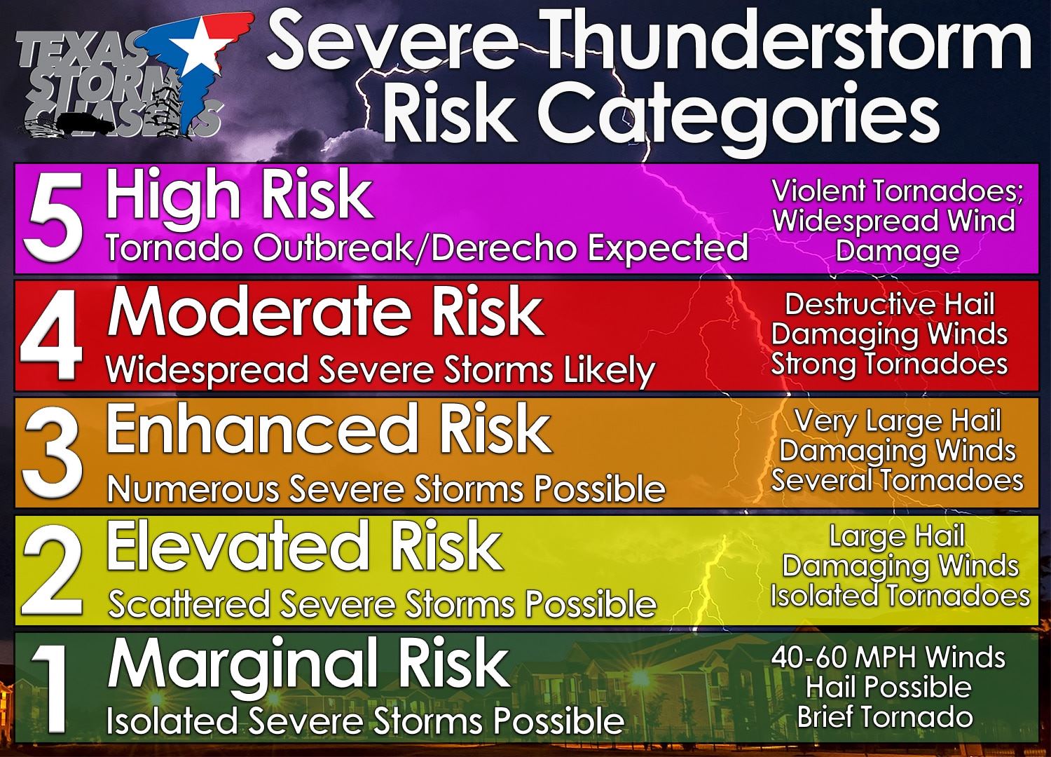
Convective Outlooks for within three days of issuance are categorized in 6 levels. They are:
TSTM – General Thunderstorms (unlikely to pose a severe risk)
Level 1 – Marginal Risk (only 5% chance of severe weather within 25 miles of any location in the risk area)
Level 2 – Slight Risk (15% probability)
Level 3 – Enhanced Risk (30%)
Level 4 – Moderate Risk (45%)
Level 5 – High Risk (60%…it is very rare to reach this level; an issuance justifies an immense amount of precaution)
When you see that SPC issues one of these risks for that day (DAY 1 Convective Outlook), you can find the probabilities of TORNADOES, DAMAGING WIND, and SEVERE HAIL along with a synopsis on their website. SPC uses real-time satellite, radar, weather balloon data, in-situ observations, and high resolution modeling data to predict how likely severe hazards are so that you can have the most detailed and accurate forecast far in advance. See the full run down here: http://www.spc.noaa.gov/misc/SPC_probotlk_info.html and in our severe weather center at TexasStormChasers.com/severe-weather


0 Comments