
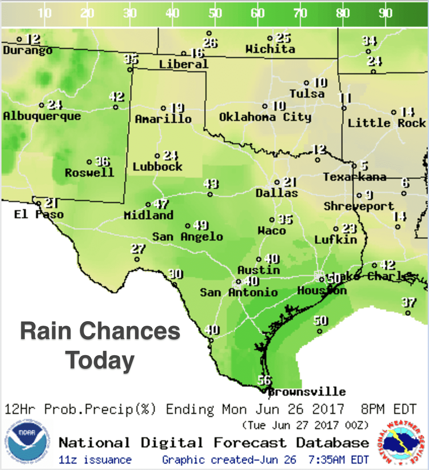
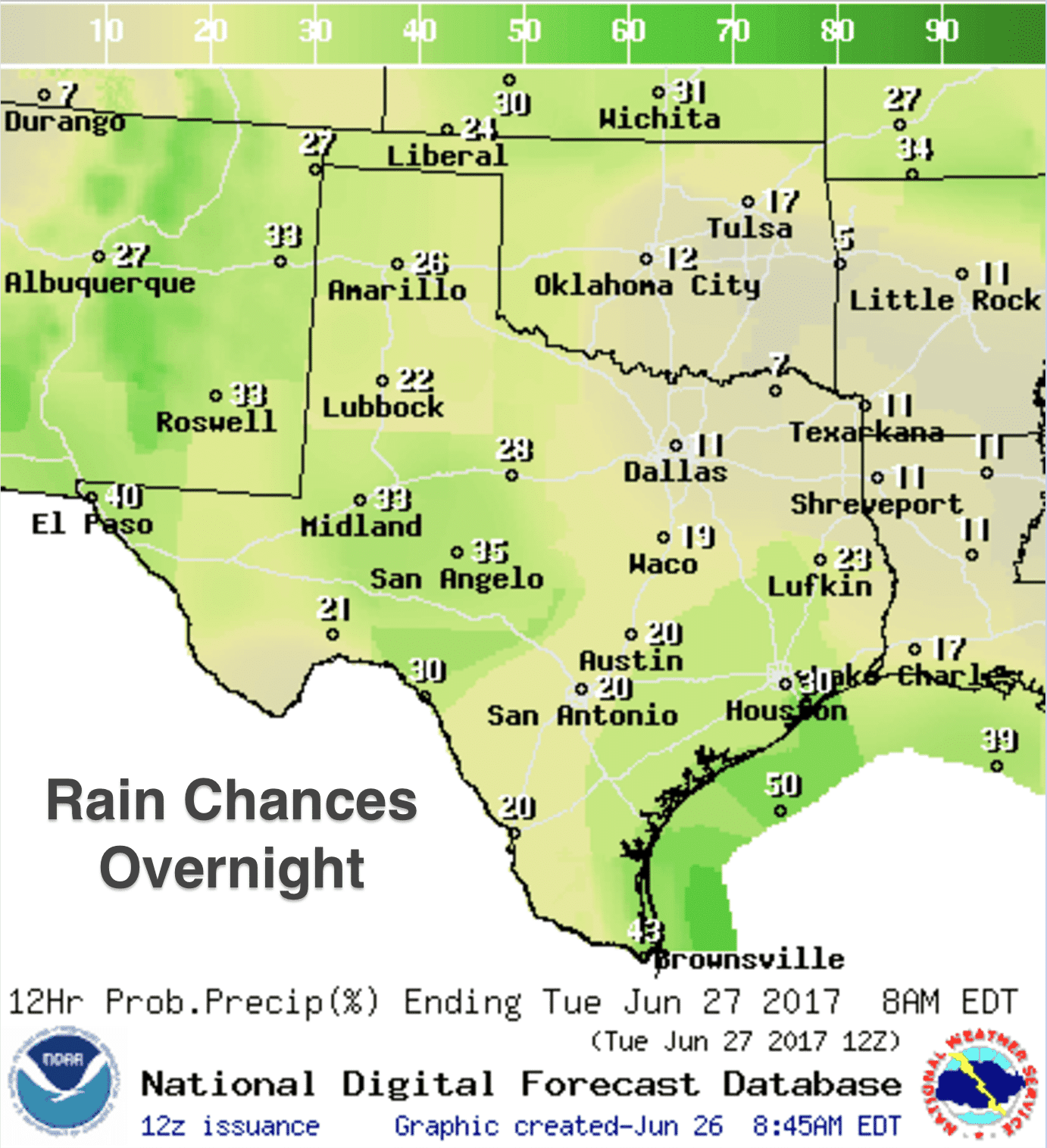
The remnants of yesterday evening’s strong storms across the panhandle and far western Texas regions continues to dissipate this morning. A lull in activity is expected across western Texas, but strong to severe storms are expected to develop again later this afternoon across eastern New Mexico and southeastern Colorado and move into the western panhandle and far western Texas later this afternoon. The Storm Prediction Center has outlined this region with a Marginal Risk (Level 1) of seeing severe storms later this afternoon and evening. Storm coverage today is not expected to be as great as yesterday, but we still could see a few storms become severe with a large hail and gusty wind threat. Further east across central and south central Texas, widespread scattered showers and a few thunderstorms are also likely this afternoon as we reach peak daytime heating. For coastal zones, pop-up showers and storms will continue to develop just offshore this morning with a tendency to move inland with the daily seabreeze as we get into the afternoon hours. Severe weather is not expected outside of the Marginal Risk area, so the main issues will be gusty winds, isolated heavy downpours and lightning…and a welcome shot of rainfall to help keep drought conditions at bay for a little longer.
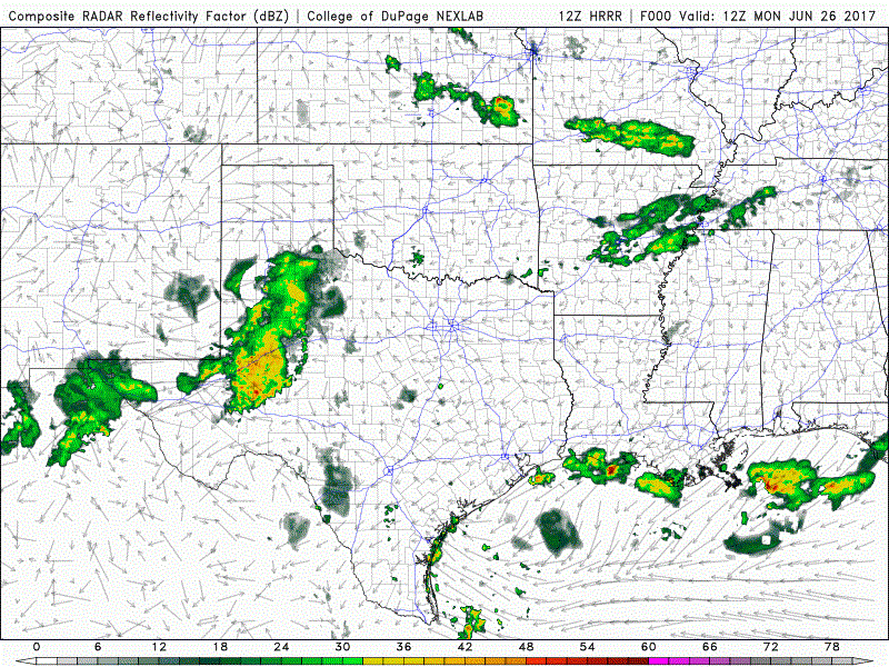
Here’s a peek at the simulated model forecast radar between now and about 1am tomorrow morning. As we always say, keep in mind this is just what the computer is projecting and reality could shape up a bit differently. But it’s a good look at the potential for weather activity throughout the day.
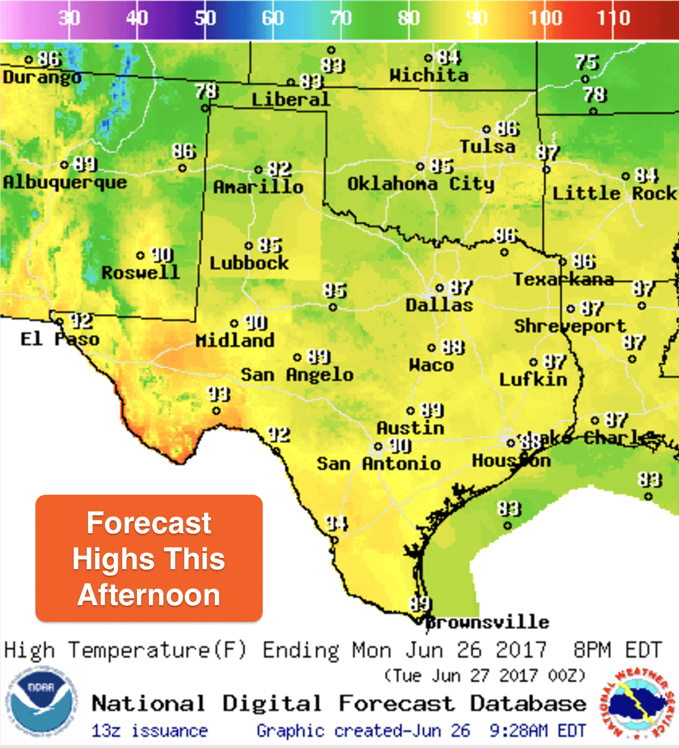
Highs today remain on the cool side for late June. Enjoy it now because we will heat up as we get further into the week and high pressure begins to build in from the west.


0 Comments