
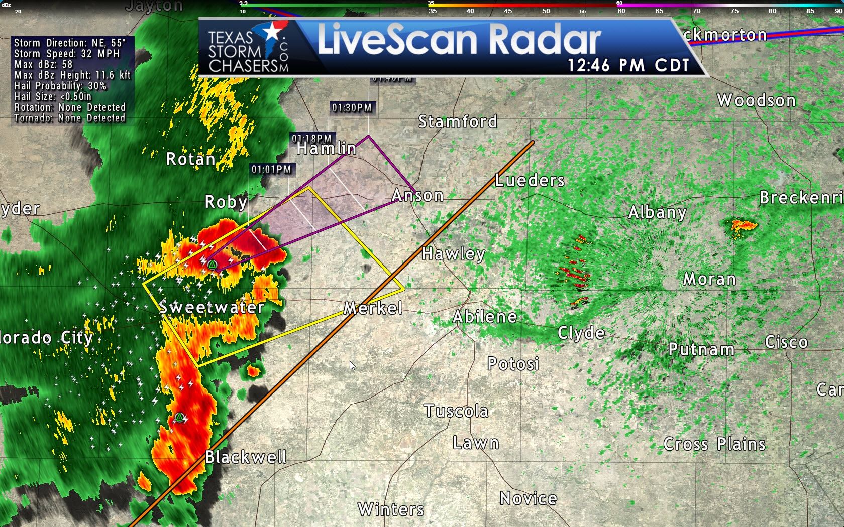
A small complex of thunderstorms is located near Sweetwater moving northeast at 40 MPH. This complex was recently warned for damaging wind gusts near 60 MPH and small hail. It’ll impact Abilene within the next hour. Those out in that area will notice a photogenically impressive shelf cloud on the leading edge of these storms.
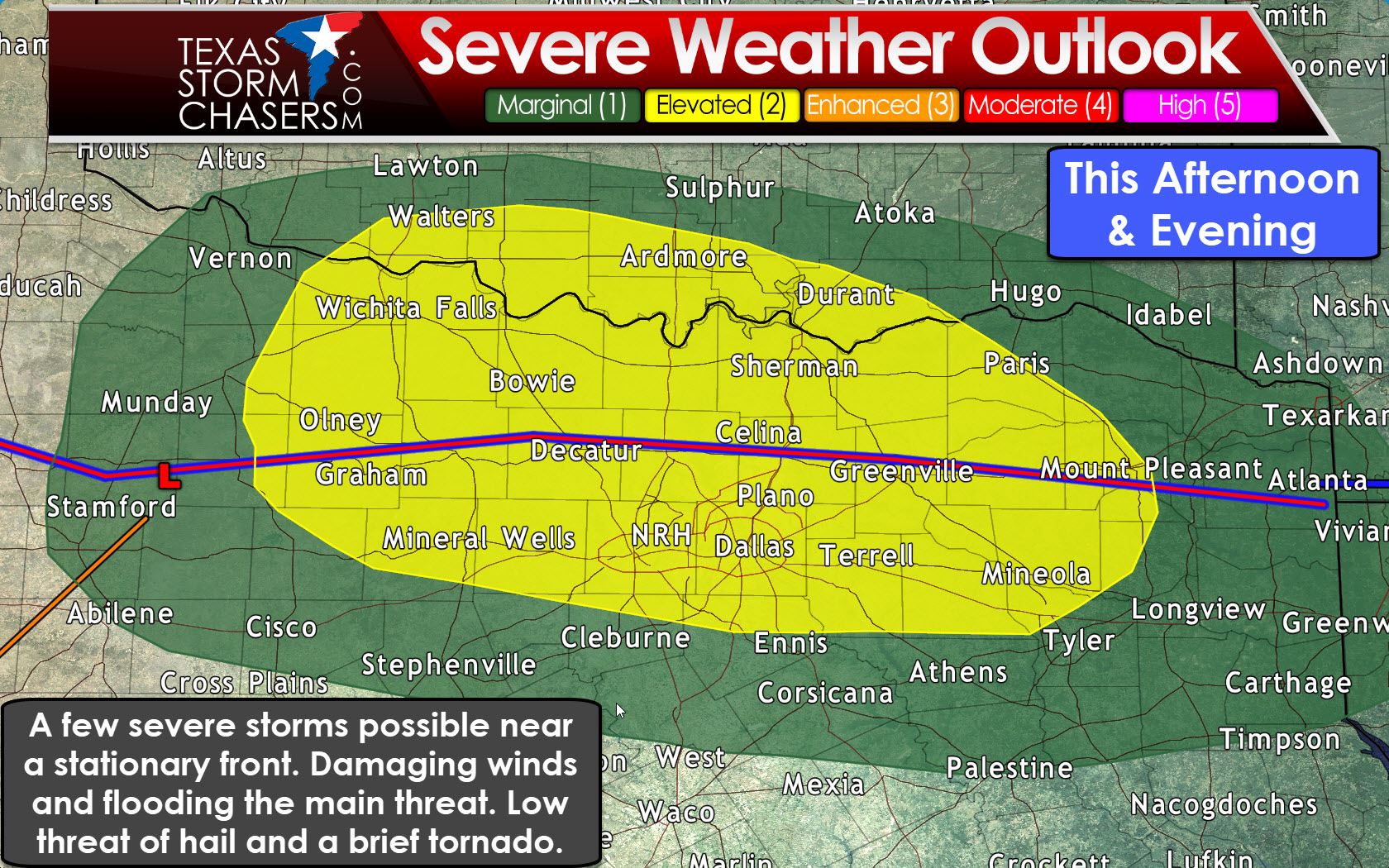
Focus for this afternoon and early evening will be along a stationary front in North Texas and Texoma. While unusual for August, there will be adequate wind shear to support organized thunderstorms. The first storms that fire up by the mid afternoon may be supercellular in nature with a threat of damaging wind gusts and large hail. If we see patches of clearing sky this severe weather threat may become more certain. If we get more rain/clouds the threat for organized severe weather may tend to be lower. However, as demonstrated by the storms out by Abilene, we do have the ingredients in place to support damaging wind gusts.
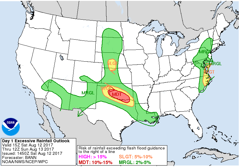
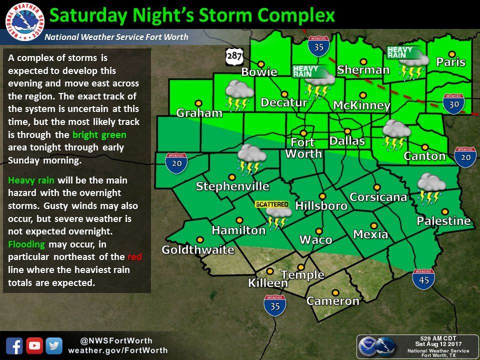
With time we expect a complex of thunderstorms to evolve across Oklahoma into Texoma this evening. These storms may have some damaging wind gusts, but the primary threat will likely evolve into a flooding event. Copious amounts of moisture combined with the stalled front will allow for training thunderstorms. Those training storms may produce several inches of rain in a short period (one to three hours). A Flash Flood Watch is in effect for the Red River counties of North and Northeast Texas, but I am a tad concerned we may see the flooding threat extend south into the D/FW Metroplex this evening and overnight. It all will depend on exactly where that stalled front sets up shop. The flooding threat will be highest in the proximity of that front tonight.


0 Comments