
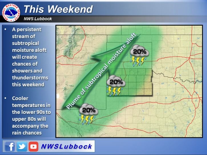
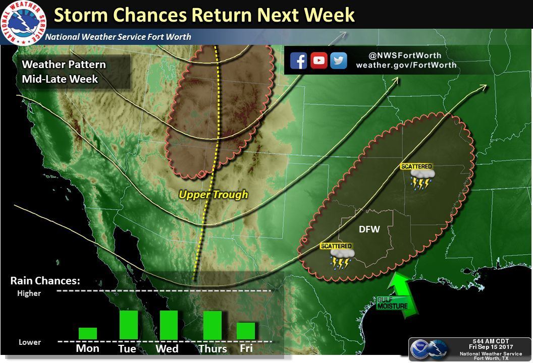
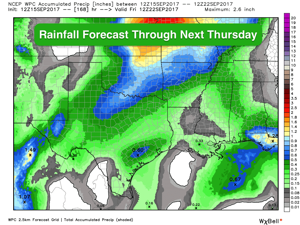
Chances for rain and storms will continue for the next several days across the western half of the state as an upper level trough remains situated to our west. Hurricane Norma, currently located just south of the Baja peninsula, will make landfall on Monday and moisture from her remnants will continue to be pulled up across the region into early next week as well. Rain and additional cloud cover across western Texas will help to keep temps in check and closer to seasonal today and through the weekend. The eastern half of the state is expected to remain under the influence of high pressure through the weekend which will keep things dry and unseasonably warm. Once we get into early part of next week, we’ll begin to see a bit of a pattern change with chances for showers and storms expanding eastward…good news for residents in central Texas and northern Texas which have been locked in a rain-free pattern for the past several weeks.
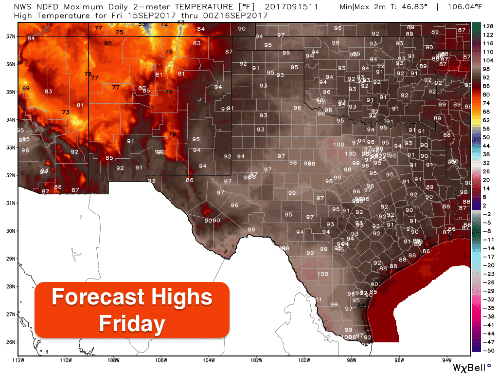
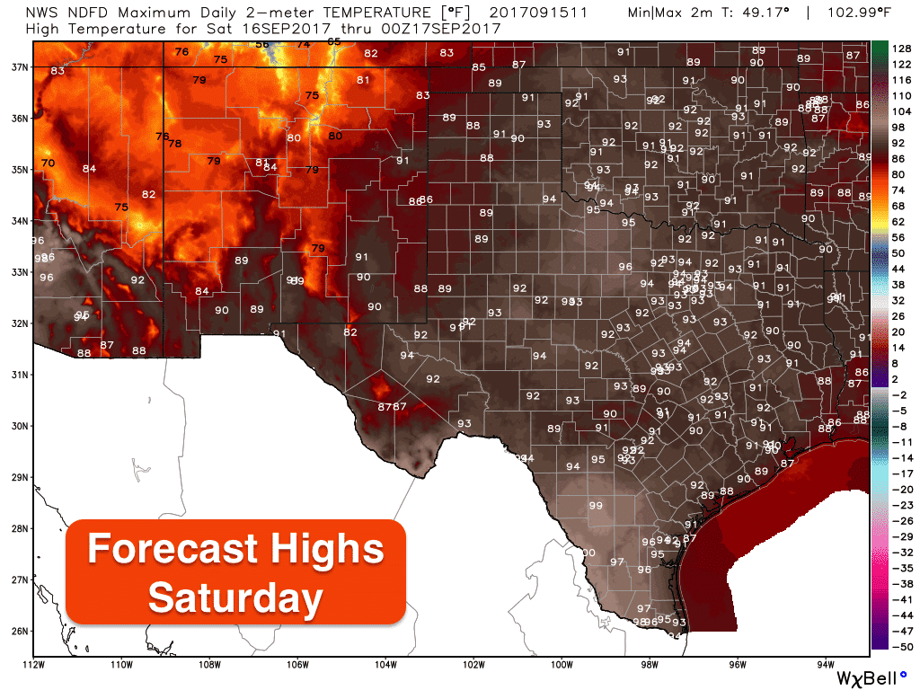
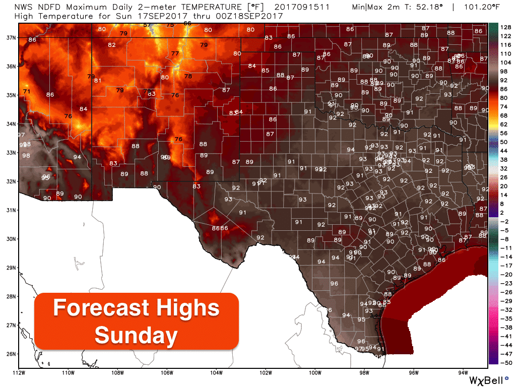
Here’s a look at the forecast highs today and over the weekend. We’ll see highs a good 5-10 above normal for much of central and north central Texas. Both Saturday and Sunday will be a few degrees cooler overall, but an increase in moisture/humidity levels will offset any decrease in temps which will make it still feel a bit uncomfortable out during the heat of the afternoon. Looking ahead at the long range forecast, not seeing much credible evidence now that we’ll see any strong cold fronts until we get closer to the end of the month. The overall pattern for the next 6-10 days will be above average temps with increasing chances for seeing rain.


0 Comments