
Major Hurricane Willa in the eastern Pacific will make landfall later today in West-Central/Southwest Mexico, near Las Islas Marias. We in Texas will not experience any wind, surge, or associated tropical-cyclone hazards. However, the remnants of Willa (including its moisture) will surge northeast into southern parts of Texas later tonight and on Wednesday. A fairly widespread round of rain is expected from the Borderland to western Texas tonight into Wednesday morning. That rain will move east across a majority of the state on Wednesday and Wednesday Night. Fourtinietly, this system will be a quick-hitter and will exit stage right on Thursday. We should be in the clear by Thursday evening with a beautiful weekend in the cards.
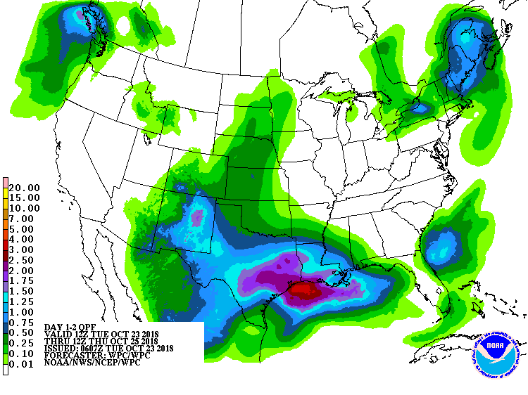
Potential rain totals from today through Wednesday night.
The highest rain totals over the next two days are anticipated to be from the Edwards Plateau east through South-Central Texas into East Texas and Southeast Texas. Rainfall amounts of one to three inches are anticipated. Some will see less and some may see more. Three-quarters of an inch up to one and a half inches will be possible from the Trans-Pecos and Permian Basin eastward through the Concho Valley and Hill Country. Amounts will be lighter across the Texas Panhandle, Northwest Texas, and across Deep South Texas into the Rio Grande Valley.
By normal Texas definitions, this upcoming two-day rain wouldn’t be a big deal. However, antecedent conditions say otherwise. Saturated soils and multiple river basins in flood from the Concho Valley eastward into Southeast Texas. These new rain totals should not be high enough to widespread flash flooding (hopefully), but run-off will likely result in quick rises in tributaries and rivers.
Forecasting river levels with the new rain will be up to the forecasters and engineers at river forecast centers and flood control districts. We are not anticipating heavy rain totals seen last week in the Concho Valley and Hill Country, but given wet soil conditions and lakes/rivers in flood, that may not matter.
A much-needed break from the rain and a beautiful weekend forecast
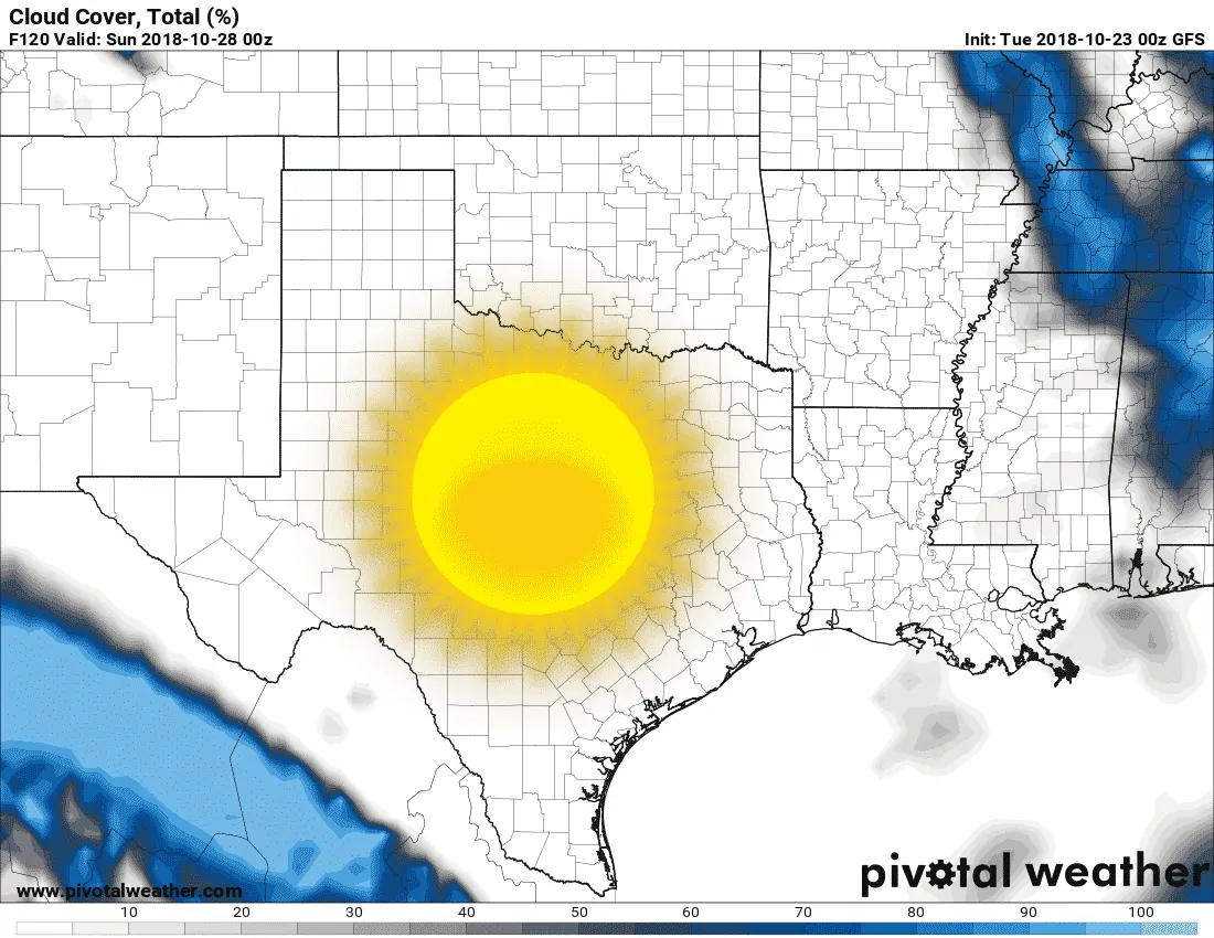
Weather-model cloud cover data for Saturday
How about I share some good news? Rains will move out from west to east on Thursday. As we head into Friday and the weekend the weather is looking absolutely beautiful. The American long-range weather model has an area of high pressure set up over South Texas on Saturday. Clear skies and lower humidity would result state-wide with high temperatures in the 60s, 70s, and 80s with dewpoints in the 40s and 50s. Warm days, cool nights, and finally a beautiful weekend in the weather department. This period should allow for several days of drying out. Our next weather maker looks like it could arrive around Halloween.


0 Comments